|
search place name
|
||
Macomber Palms (California, United States - USA)Macomber Palms is a town in the California region of United States - USA. An overview map of the region around Macomber Palms is displayed below.
regional and 3d topo map of Macomber Palms, United States - USA ::

Macomber Palms airports ::
The nearest airport is PSP - Palm Springs Intl, located 23.6 km west of Macomber Palms.
Other airports nearby include RIV - Riverside March Arb (93.5 km west), RAL - Riverside Muni (111.5 km west), NJK - El Centro Naf (120.4 km south east), ONT - Ontario Intl (127.8 km west), Nearby towns ::
Biskra Palms (1.0km south) //
Indio Hills (4.2km north east) //
Hidden Palms (4.9km north west) //
Bermuda Dunes (7.0km south west) //
Arabian Gardens Mobile Home Park (7.7km south) //
Willis Palms (7.6km north west) //
Indio (9.4km south east) //
Indian Wells (10.2km south west) //
[all distances 'as the bird flies' and approximate] 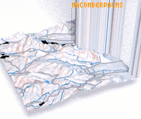 Places with similar names to Macomber Palms, United States - USA :: Disclaimer :: Information on this page comes without warranty of any kind |
||
|
Where is Macomber Palms? Elevation and coordinates ::
Latitude (lat): 33°47'55"N Longitude (lon): 116°15'16"W
Elevation (approx.): 150m (map arrows pan, magnifying glasses zoom) |
||
|
Visiting Macomber Palms? Hotel/Accommodation ::
Book a hotel in Macomber Palms Travel Guide ::
rental cars ::
car rental offers GPS waypoint ::
download a GPX waypoint (PoI) of Macomber Palms for your GPS receiver
|
||