|
search place name
|
||
Stanley (California, United States - USA)Stanley is a town in the California region of United States - USA. An overview map of the region around Stanley is displayed below.
regional and 3d topo map of Stanley, United States - USA ::

Stanley airports ::
The nearest airport is SUU - Fairfield Travis Afb, located 32.0 km east of Stanley.
Other airports nearby include OAK - Metropolitan Oakland Intl (58.4 km south), SFO - San Francisco Intl (69.8 km south), SAC - Sacramento Executive (75.9 km north east), SMF - Sacramento Intl (79.1 km north east), Nearby towns ::
Suscol (0.8km east) //
Thompson (1.2km south east) //
Rocktram (1.8km north east) //
Cuttings Wharf (2.4km south west) //
Shipyard Acres (2.6km north east) //
Imola (3.9km north) //
Brazos (4.2km south) //
Buchli (4.7km south west) //
Middleton (5.0km south east) //
Squab (5.5km south) //
Lombard (6.8km south east) //
American Canyon (8.3km south) //
Union (8.6km north) //
Lowell (8.6km south east) //
Merazo (7.5km south west) //
Collins (9.5km south) //
[all distances 'as the bird flies' and approximate] 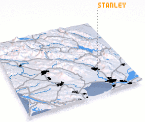 Places with similar names to Stanley, United States - USA ::
Disclaimer :: Information on this page comes without warranty of any kind |
||
|
Where is Stanley? Elevation and coordinates ::
Latitude (lat): 38°14'41"N Longitude (lon): 122°17'34"W
Elevation (approx.): 3m (map arrows pan, magnifying glasses zoom) |
||
|
Visiting Stanley? Hotel/Accommodation ::
Book a hotel in Stanley Travel Guide ::
rental cars ::
car rental offers GPS waypoint ::
download a GPX waypoint (PoI) of Stanley for your GPS receiver
|
||