|
search place name
|
||
Plumbs (Colorado, United States - USA)Plumbs is a town in the Colorado region of United States - USA. An overview map of the region around Plumbs is displayed below.
regional and 3d topo map of Plumbs, United States - USA ::

Plumbs airports ::
The nearest airport is DEN - Denver Intl, located 40.4 km south east of Plumbs.
Other airports nearby include BKF - Buckley Afb (49.6 km south east), CYS - Cheyenne Rgnl Jerry Olson Fld (120.2 km north), COS - City Of Colorado Springs Muni (145.4 km south), PUB - Pueblo Memorial Pueblo Mem (205.2 km south), Nearby towns ::
Pleasant View Ridge (3.4km north) //
Erie (4.2km south) //
Gooding (3.7km south west) //
Puritan (3.8km east) //
Canfield (4.6km south west) //
Idaho Creek (4.6km north east) //
Tabor (4.8km south west) //
Jessum (5.9km north) //
Rinn (6.9km north east) //
Leyner (6.5km south west) //
Ninemile Corner (9.5km south west) //
Longmont (10.1km north west) //
[all distances 'as the bird flies' and approximate] 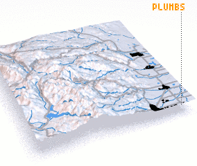 Places with similar names to Plumbs, United States - USA ::
// Palomas (US)
// Plomosa (US)
// Palma Ceia (US)
// Pollmoos (DE)
// Palmas (IT)
// Palamás (GR)
// Palamás (GR)
// Palames (PT)
// Palmaz (PT)
// Półmieście (PL)
Disclaimer :: Information on this page comes without warranty of any kind |
||
|
Where is Plumbs? Elevation and coordinates ::
Latitude (lat): 40°5'16"N Longitude (lon): 105°2'36"W
Elevation (approx.): 1520m (map arrows pan, magnifying glasses zoom) |
||
|
Visiting Plumbs? Hotel/Accommodation ::
Book a hotel in Plumbs Travel Guide ::
rental cars ::
car rental offers GPS waypoint ::
download a GPX waypoint (PoI) of Plumbs for your GPS receiver
|
||