|
search place name
|
||
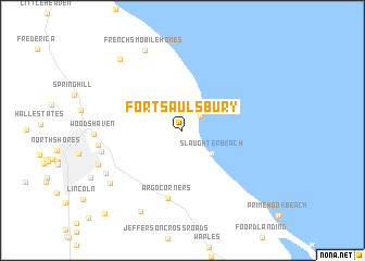
Fort Saulsbury (Delaware, United States - USA)Fort Saulsbury is a town in the Delaware region of United States - USA. An overview map of the region around Fort Saulsbury is displayed below.
regional and 3d topo map of Fort Saulsbury, United States - USA ::
Fort Saulsbury airports ::
The nearest airport is DOV - Dover Afb, located 24.6 km north west of Fort Saulsbury.
Other airports nearby include WWD - Wildwood Cape May Co (37.6 km east), MIV - Millville Muni (53.1 km north east), SBY - Salisbury Ocean City Wicomico Rgnl (67.7 km south), ILG - Wilmington New Castle (86.0 km north), Nearby towns ::
Mispillion Light (2.1km north east) //
Slaughter Beach (3.3km south east) //
Argo Corners (7.1km south) //
Brown Street (6.8km west) //
Bowen Landing (6.9km west) //
Shawnee Acres (7.5km south west) //
Frenchs Mobile Homes (8.8km north) //
White Oak Mobile Home Park (7.9km south west) //
Country Club Estates (7.6km south west) //
Anderson Crossroads (9.0km south) //
Thompsonville (8.9km north west) //
Pondside Acres (10.6km south west) //
[all distances 'as the bird flies' and approximate]  Places with similar names to Fort Saulsbury, United States - USA :: Disclaimer :: Information on this page comes without warranty of any kind |
||
|
Where is Fort Saulsbury? Elevation and coordinates ::
Latitude (lat): 38°56'2"N Longitude (lon): 75°19'55"W
Elevation (approx.): 2m (map arrows pan, magnifying glasses zoom) |
||
|
Visiting Fort Saulsbury? Hotel/Accommodation ::
Book a hotel in Fort Saulsbury Travel Guide ::
rental cars ::
car rental offers GPS waypoint ::
download a GPX waypoint (PoI) of Fort Saulsbury for your GPS receiver
|
||