|
search place name
|
||
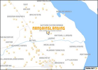
Nandains Landing (Delaware, United States - USA)Nandains Landing is a town in the Delaware region of United States - USA. An overview map of the region around Nandains Landing is displayed below.
regional and 3d topo map of Nandains Landing, United States - USA ::
Nandains Landing airports ::
The nearest airport is DOV - Dover Afb, located 15.7 km south of Nandains Landing.
Other airports nearby include MIV - Millville Muni (41.0 km east), ILG - Wilmington New Castle (46.7 km north), APG - Aberdeen Phillips Aaf (59.7 km north west), WWD - Wildwood Cape May Co (60.5 km south east), Nearby towns ::
Whitehall Crossroads (0.8km north east) //
Leipsic (2.6km south) //
Dutch Neck Crossroads (2.8km north) //
Hazelwood (4.9km south) //
Whitehall Landing (4.6km east) //
Eberton (6.0km south west) //
Bethel (5.6km south west) //
Big Oak Corners (5.3km west) //
Hickory Dale Acres (6.4km south west) //
Hammville (5.9km south west) //
Windy Way (5.3km west) //
Bishops Corner (6.0km south west) //
Village of Garrison Lake (5.3km west) //
Hedgerow Hollow Mobile Home Park (5.5km west) //
Lawndale (5.6km west) //
Delshire (6.8km south west) //
Del Shire (6.8km south west) //
Bush Manor (6.8km south west) //
Taylors Gut Landing (7.3km north) //
Hickory Ridge (5.8km west) //
Sabarto East (6.8km south west) //
Pleasanton Acres (7.2km south) //
Marker Estates (7.1km south west) //
Dupont Manor (7.6km south) //
Woodland Court Mobile Home Park (6.9km north west) //
Cheswold (7.0km south west) //
Hoars Addition (7.2km south west) //
Hughes Crossing (7.7km south west) //
Brick Store (7.7km north west) //
[all distances 'as the bird flies' and approximate] 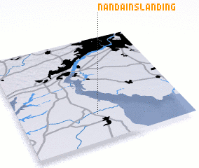 Places with similar names to Nandains Landing, United States - USA :: Disclaimer :: Information on this page comes without warranty of any kind |
||
|
Where is Nandains Landing? Elevation and coordinates ::
Latitude (lat): 39°15'45"N Longitude (lon): 75°31'40"W
Elevation (approx.): 3m (map arrows pan, magnifying glasses zoom) |
||
|
Visiting Nandains Landing? Hotel/Accommodation ::
Book a hotel in Nandains Landing Travel Guide ::
rental cars ::
car rental offers GPS waypoint ::
download a GPX waypoint (PoI) of Nandains Landing for your GPS receiver
|
||