|
search place name
|
||
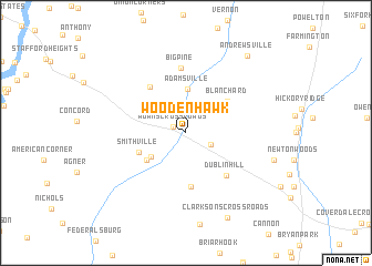
Woodenhawk (Delaware, United States - USA)Woodenhawk is a town in the Delaware region of United States - USA. An overview map of the region around Woodenhawk is displayed below.
regional and 3d topo map of Woodenhawk, United States - USA ::
Woodenhawk airports ::
The nearest airport is DOV - Dover Afb, located 42.3 km north east of Woodenhawk.
Other airports nearby include SBY - Salisbury Ocean City Wicomico Rgnl (52.5 km south), WWD - Wildwood Cape May Co (72.0 km east), MIV - Millville Muni (83.4 km north east), NHK - Patuxent River Nas (84.3 km south west), Nearby towns ::
Adams Crossroads (1.1km north west) //
Scotts Corner (2.3km south east) //
Woodenhawk Pines (3.6km south west) //
Adamsville (4.4km north) //
Bloomery (4.2km south west) //
Smithville (4.2km south west) //
Blanchard (4.6km north east) //
Jacobs Crossroads (5.4km south) //
Hickman (5.4km north west) //
Hickman (5.4km north west) //
Dublin Hill (5.3km south east) //
Big Pine (6.6km north) //
Cocked Hat (7.4km east) //
Clarksons Crossroads (9.2km south) //
Andrewsville (9.1km north east) //
[all distances 'as the bird flies' and approximate]  Places with similar names to Woodenhawk, United States - USA :: Disclaimer :: Information on this page comes without warranty of any kind |
||
|
Where is Woodenhawk? Elevation and coordinates ::
Latitude (lat): 38°47'30"N Longitude (lon): 75°41'26"W
Elevation (approx.): 13m (map arrows pan, magnifying glasses zoom) |
||
|
Visiting Woodenhawk? Hotel/Accommodation ::
Book a hotel in Woodenhawk Travel Guide ::
rental cars ::
car rental offers GPS waypoint ::
download a GPX waypoint (PoI) of Woodenhawk for your GPS receiver
|
||