|
search place name
|
||
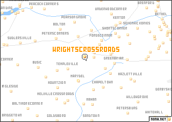
Wrights Crossroads (Delaware, United States - USA)Wrights Crossroads is a town in the Delaware region of United States - USA. An overview map of the region around Wrights Crossroads is displayed below.
regional and 3d topo map of Wrights Crossroads, United States - USA ::
Wrights Crossroads airports ::
The nearest airport is DOV - Dover Afb, located 23.0 km east of Wrights Crossroads.
Other airports nearby include APG - Aberdeen Phillips Aaf (51.5 km north west), ILG - Wilmington New Castle (59.5 km north), MIV - Millville Muni (61.7 km north east), WWD - Wildwood Cape May Co (72.9 km east), Nearby towns ::
Slaughter (1.6km north east) //
Hartly (2.4km north east) //
Templeville (3.5km south west) //
Bethesda (3.6km south east) //
Marydel (4.5km south) //
Marydel (4.6km south) //
Oak Forest Estates (4.3km north east) //
Davis Corner (4.5km east) //
Fords Corner (5.2km north east) //
Everetts Corner (5.6km north) //
Hourglass (5.0km south east) //
Forrest Grove Village Mobile Home Park (4.9km north east) //
Green Briar (4.8km east) //
Smith Crossroads (6.4km south) //
Cleaves Fork (5.3km south west) //
Downs Chapel (6.8km north) //
Chapeltown (6.5km south east) //
Peters Corners (7.1km north west) //
Mount Zion (7.5km south west) //
Shorts Corner (7.9km north east) //
Bolton (8.2km north west) //
Seeneytown (7.7km north east) //
Pearson Grove (8.8km north) //
Kane Crossroads (7.7km south west) //
Henderson (9.2km south) //
Oak Point Acres (8.3km south east) //
Whigville (9.3km north east) //
Melville Crossroads (9.7km south west) //
Kenton (10.2km north east) //
[all distances 'as the bird flies' and approximate]  Places with similar names to Wrights Crossroads, United States - USA :: Disclaimer :: Information on this page comes without warranty of any kind |
||
|
Where is Wrights Crossroads? Elevation and coordinates ::
Latitude (lat): 39°9'6"N Longitude (lon): 75°43'50"W
Elevation (approx.): 22m (map arrows pan, magnifying glasses zoom) |
||
|
Visiting Wrights Crossroads? Hotel/Accommodation ::
Book a hotel in Wrights Crossroads Travel Guide ::
rental cars ::
car rental offers GPS waypoint ::
download a GPX waypoint (PoI) of Wrights Crossroads for your GPS receiver
|
||