|
search place name
|
||
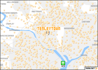
Tenleytown (District of Columbia, United States - USA)Tenleytown is a town in the District of Columbia region of United States - USA. An overview map of the region around Tenleytown is displayed below.
regional and 3d topo map of Tenleytown, United States - USA ::
Tenleytown airports ::
The nearest airport is DCA - Ronald Reagan Washington Natl, located 11.6 km south of Tenleytown.
Other airports nearby include ADW - Camp Springs Andrews Afb (Washington Dc Naf) (24.5 km south east), IAD - Washington Dulles Intl (32.1 km west), BWI - Baltimore Washington Intl (44.0 km north east), NHK - Patuxent River Nas (94.2 km south east), Nearby towns ::
American University Park (0.4km north west) //
Reno (0.7km north east) //
Friendship Heights (1.0km north east) //
Brookdale (1.2km north west) //
Chevy Chase Heights (1.3km north east) //
Westover Place (1.5km south) //
Friendship Village (1.5km north) //
Glen Cove (1.3km north west) //
Westmoreland Terrace (1.2km west) //
Embassy Park (1.6km south) //
Friendship Heights (1.6km north) //
Crestview (1.3km west) //
North Cleveland Park (1.3km east) //
McLean Gardens (1.6km south east) //
Spring Valley (1.6km south west) //
Westgate (1.5km north west) //
Green Acres (1.7km north west) //
Wesley Heights (2.0km south) //
Sutton Place (2.0km south) //
Somerset (2.0km north west) //
Westmoreland Hills (1.7km west) //
Chevy Chase Village (2.3km north) //
Spring Hill (1.8km west) //
Somerset Heights (2.3km north) //
Pinehurst Circle (2.4km north) //
Chevy Chase (2.2km north east) //
Chevy Chase (2.5km north) //
Drummond (2.5km north west) //
Kent (2.3km south west) //
[all distances 'as the bird flies' and approximate]  Places with similar names to Tenleytown, United States - USA ::
// Taunleiten (AT)
// Tunnelton (US)
// Dennilton (ZA)
// Danleyton (US)
// Danieltown (US)
// Donnellytown (US)
// Tunnelton (US)
// Danieltown (US)
// Dan Ladan (NG)
// Tunnelton (US)
Disclaimer :: Information on this page comes without warranty of any kind |
||
|
Where is Tenleytown? Elevation and coordinates ::
Latitude (lat): 38°56'58"N Longitude (lon): 77°5'10"W
Elevation (approx.): 99m (map arrows pan, magnifying glasses zoom) |
||
|
Visiting Tenleytown? Hotel/Accommodation ::
Book a hotel in Tenleytown Travel Guide ::
rental cars ::
car rental offers GPS waypoint ::
download a GPX waypoint (PoI) of Tenleytown for your GPS receiver
|
||