|
search place name
|
||
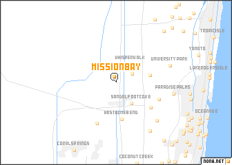
Mission Bay (Florida, United States - USA)Mission Bay is a town in the Florida region of United States - USA. An overview map of the region around Mission Bay is displayed below.
regional and 3d topo map of Mission Bay, United States - USA ::
Mission Bay airports ::
The nearest airport is FLL - Fort Lauderdale Hollywood Intl, located 33.4 km south of Mission Bay.
Other airports nearby include PBI - West Palm Beach Palm Beach Intl (36.6 km north), MIA - Miami Intl (64.4 km south), HST - Homestead Arb (99.2 km south), BIM - Alice Town South Bimini (120.2 km south east), Nearby towns ::
Hamptons at Boca Raton (2.8km north east) //
Whisper Walk (3.6km north east) //
Sandalfoot Cove (4.1km south east) //
Boca West (5.1km east) //
West Dixie Bend (6.1km south) //
Boca Pointe (6.5km south east) //
Parkland (7.2km south) //
Boca Del Mar (6.9km south east) //
West Deerfield Beach (8.6km south east) //
University Park (8.3km east) //
Lakeview (9.3km south east) //
Kings Point (10.9km north east) //
[all distances 'as the bird flies' and approximate] 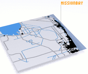 Places with similar names to Mission Bay, United States - USA ::
Disclaimer :: Information on this page comes without warranty of any kind |
||
|
Where is Mission Bay? Elevation and coordinates ::
Latitude (lat): 26°22'11"N Longitude (lon): 80°12'36"W
Elevation (approx.): 11m (map arrows pan, magnifying glasses zoom) |
||
|
Visiting Mission Bay? Hotel/Accommodation ::
Book a hotel in Mission Bay Travel Guide ::
rental cars ::
car rental offers GPS waypoint ::
download a GPX waypoint (PoI) of Mission Bay for your GPS receiver
|
||