|
search place name
|
||
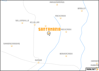
Santa Maria (Florida, United States - USA)Santa Maria is a town in the Florida region of United States - USA. An overview map of the region around Santa Maria is displayed below.
regional and 3d topo map of Santa Maria, United States - USA ::
Santa Maria airports ::
The nearest airport is CEW - Crestview Bob Sikes, located 35.4 km south east of Santa Maria.
Other airports nearby include VPS - Valparaiso Eglin Afb (59.6 km south east), PNS - Pensacola Rgnl (62.6 km south west), NPA - Pensacola Nas (80.8 km south west), BFM - Mobile Downtown (123.3 km west), Nearby towns ::
Belandville (3.8km north) //
Rock Creek (5.6km east) //
McLellan (6.4km north west) //
Rock Creek (7.5km north east) //
Beaver Creek (9.4km south east) //
[all distances 'as the bird flies' and approximate] 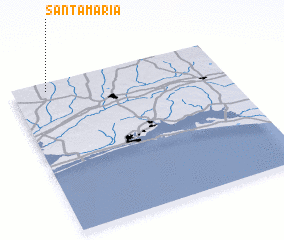 Places with similar names to Santa Maria, United States - USA ::
// Santa Maria (BR)
// Santa Maria (BR)
// Santa Maria (BR)
// Santa Maria (BR)
// Santa Maria (BR)
// Santa Maria (BR)
// Santa Maria (BR)
// Santa Maria (BR)
// Santa Maria (BR)
// Santa Maria (BR)
Disclaimer :: Information on this page comes without warranty of any kind |
||
|
Where is Santa Maria? Elevation and coordinates ::
Latitude (lat): 30°56'58"N Longitude (lon): 86°50'7"W
Elevation (approx.): 95m (map arrows pan, magnifying glasses zoom) |
||
|
Visiting Santa Maria? Hotel/Accommodation ::
Book a hotel in Santa Maria Travel Guide ::
rental cars ::
car rental offers GPS waypoint ::
download a GPX waypoint (PoI) of Santa Maria for your GPS receiver
|
||