|
search place name
|
||
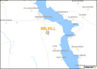
Walkill (Florida, United States - USA)Walkill is a town in the Florida region of United States - USA. An overview map of the region around Walkill is displayed below.
regional and 3d topo map of Walkill, United States - USA ::
Walkill airports ::
The nearest airport is NIP - Jacksonville Nas, located 33.1 km north of Walkill.
Other airports nearby include JAX - Jacksonville Intl (61.7 km north), GNV - Gainesville Rgnl (65.0 km south west), MCO - Orlando Intl (170.7 km south), VAD - Valdosta Moody Afb (186.2 km north west), Nearby towns ::
Leno (5.8km south) //
Green Cove Springs (6.2km north) //
Picolata (7.1km east) //
Brewers Landing (8.2km south east) //
Bass Haven (7.5km east) //
Magnolia Springs (8.8km north) //
Orangedale (9.2km north east) //
[all distances 'as the bird flies' and approximate]  Places with similar names to Walkill, United States - USA ::
// Wila Kollu (BO)
// Wila Kollu (BO)
// Wielgłowy (PL)
// Wielogłowy (PL)
// Wilkłów (PL)
// Wallkill (US)
// Walikale (CD)
// Walkul (IN)
// Wolokoli (ID)
// Waulgala (LK)
Disclaimer :: Information on this page comes without warranty of any kind |
||
|
Where is Walkill? Elevation and coordinates ::
Latitude (lat): 29°56'16"N Longitude (lon): 81°39'44"W
Elevation (approx.): 19m (map arrows pan, magnifying glasses zoom) |
||
|
Visiting Walkill? Hotel/Accommodation ::
Book a hotel in Walkill Travel Guide ::
rental cars ::
car rental offers GPS waypoint ::
download a GPX waypoint (PoI) of Walkill for your GPS receiver
|
||