|
search place name
|
||
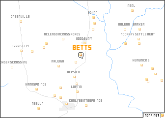
Betts (Georgia, United States - USA)Betts is a town in the Georgia region of United States - USA. An overview map of the region around Betts is displayed below.
regional and 3d topo map of Betts, United States - USA ::
Betts airports ::
The nearest airport is ATL - Hartsfield Jackson Atlanta Intl, located 77.4 km north of Betts.
Other airports nearby include LSF - Fort Benning Lawson Aaf (78.0 km south west), MCN - Macon Middle Georgia Rgnl (92.4 km east), WRB - Macon Robins Afb (99.5 km east), MGE - Marietta Dobbins Arb (Atlanta Nas) (107.1 km north), Nearby towns ::
Langdon (1.4km south west) //
Woodbury (3.6km north) //
Persico (4.3km south) //
Raleigh (4.9km west) //
Johnson Crossroads (5.7km south) //
McLendon Crossroads (5.8km north west) //
Carrolls (7.0km north) //
Loftin (7.5km south) //
Routons Crossroads (7.7km south west) //
Imlac (8.4km north) //
Andrews Crossroads (7.7km north west) //
Snelsons Crossroads (7.8km west) //
Bulloch Crossroads (9.7km south west) //
Bussey Crossroads (9.9km south west) //
[all distances 'as the bird flies' and approximate]  Places with similar names to Betts, United States - USA ::
Disclaimer :: Information on this page comes without warranty of any kind |
||
|
Where is Betts? Elevation and coordinates ::
Latitude (lat): 32°57'6"N Longitude (lon): 84°35'15"W
Elevation (approx.): 227m (map arrows pan, magnifying glasses zoom) |
||
|
Visiting Betts? Hotel/Accommodation ::
Book a hotel in Betts Travel Guide ::
rental cars ::
car rental offers GPS waypoint ::
download a GPX waypoint (PoI) of Betts for your GPS receiver
|
||