|
search place name
|
||
Burnt Creek (Georgia, United States - USA)Burnt Creek is a town in the Georgia region of United States - USA. An overview map of the region around Burnt Creek is displayed below.
regional and 3d topo map of Burnt Creek, United States - USA ::

Burnt Creek airports ::
The nearest airport is MGE - Marietta Dobbins Arb (Atlanta Nas), located 36.9 km west of Burnt Creek.
Other airports nearby include ATL - Hartsfield Jackson Atlanta Intl (42.0 km south west), MCN - Macon Middle Georgia Rgnl (142.2 km south), AND - Andersen Anderson Rgnl (144.9 km north east), WRB - Macon Robins Afb (149.4 km south), Nearby towns ::
Beaver Hills (0.9km north west) //
Lester Woods (1.3km south east) //
Pleasant Acres (1.6km north) //
Countryside Village Mobile Home Park (1.4km east) //
Luxomni (1.9km south) //
Rolling Ridge (2.9km north) //
Pleasant Hill (3.1km north) //
Lilburn (3.5km south west) //
Bethesda (3.2km east) //
Heritage Station (4.0km north east) //
Cedar Creek (4.8km south) //
The Wildings (5.1km north east) //
Regency Woods (5.0km north east) //
Metropolitan Mobile Home Park (4.9km north west) //
Gloster (4.8km east) //
River Oak (5.3km south east) //
Carrefour Place (5.8km south west) //
Adams Crossroads (6.1km north) //
Hopkins Mill (5.7km north west) //
Sweet Water (5.3km east) //
Camp Creek Estates (6.3km south) //
Wyloway (5.4km west) //
Plantation Woods (5.6km north east) //
Four Winds (6.2km south west) //
Ansley Brook (5.5km east) //
Berkeley Hills (5.9km north west) //
Jones Mobile Home Park (5.7km west) //
Coopers Pond (5.8km east) //
Five Forks (6.1km south east) //
[all distances 'as the bird flies' and approximate] 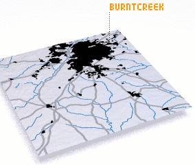 Places with similar names to Burnt Creek, United States - USA ::
Disclaimer :: Information on this page comes without warranty of any kind |
||
|
Where is Burnt Creek? Elevation and coordinates ::
Latitude (lat): 33°54'46"N Longitude (lon): 84°7'3"W
Elevation (approx.): 280m (map arrows pan, magnifying glasses zoom) |
||
|
Visiting Burnt Creek? Hotel/Accommodation ::
Book a hotel in Burnt Creek Travel Guide ::
rental cars ::
car rental offers GPS waypoint ::
download a GPX waypoint (PoI) of Burnt Creek for your GPS receiver
|
||