|
search place name
|
||
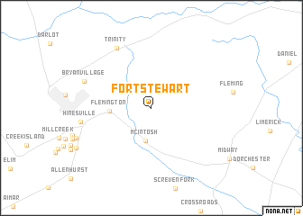
Fort Stewart (Georgia, United States - USA)Fort Stewart is a town in the Georgia region of United States - USA. An overview map of the region around Fort Stewart is displayed below.
regional and 3d topo map of Fort Stewart, United States - USA ::
Fort Stewart airports ::
The nearest airport is SVN - Hunter Aaf, located 38.8 km north east of Fort Stewart.
Other airports nearby include SAV - Savannah Hilton Head Intl (41.9 km north east), NBC - Beaufort Mcas (101.3 km north east), JAX - Jacksonville Intl (152.6 km south), AGS - Bush Field Augusta Rgnl At Bush Fld (172.3 km north), Nearby towns ::
McIntosh (4.1km south) //
Flemington (4.4km west) //
Trinity (8.3km north west) //
Hinesville (7.6km west) //
Bryan Village (7.8km north west) //
[all distances 'as the bird flies' and approximate] 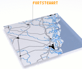 Places with similar names to Fort Stewart, United States - USA ::
// Fort Stewart (JM)
// Fort Stewart (IE)
Disclaimer :: Information on this page comes without warranty of any kind |
||
|
Where is Fort Stewart? Elevation and coordinates ::
Latitude (lat): 31°51'45"N Longitude (lon): 81°31'4"W
Elevation (approx.): 10m (map arrows pan, magnifying glasses zoom) |
||
|
Visiting Fort Stewart? Hotel/Accommodation ::
Book a hotel in Fort Stewart Travel Guide ::
rental cars ::
car rental offers GPS waypoint ::
download a GPX waypoint (PoI) of Fort Stewart for your GPS receiver
|
||