|
search place name
|
||
Gay Lan (Georgia, United States - USA)Gay Lan is a town in the Georgia region of United States - USA. An overview map of the region around Gay Lan is displayed below.
regional and 3d topo map of Gay Lan, United States - USA ::

Gay Lan airports ::
The nearest airport is MGE - Marietta Dobbins Arb (Atlanta Nas), located 56.9 km south west of Gay Lan.
Other airports nearby include ATL - Hartsfield Jackson Atlanta Intl (71.8 km south west), AND - Andersen Anderson Rgnl (122.3 km east), CHA - Chattanooga Lovell Fld (148.5 km north west), MCN - Macon Middle Georgia Rgnl (165.9 km south), Nearby towns ::
Johnson (1.1km north east) //
Beard (1.8km south) //
Woodlake (1.9km north) //
Green Crossing (2.0km south) //
Misty Cove (2.5km north) //
Lake Forest (2.6km south west) //
Hammer (3.0km north east) //
Rest Haven (3.3km south) //
Woodbridge (2.8km east) //
Pebble Brook (4.6km south) //
Forest Park (4.0km east) //
Wayne (4.1km east) //
Loch Arbor (4.5km north east) //
Lake Lanier Vista (4.4km south west) //
Roberts Crossroads (5.0km south east) //
Buford (5.4km south west) //
Northwest Harbor (5.0km south west) //
Trudy Estates (5.6km north east) //
Springlake Estates (6.1km south) //
Flowery Branch (5.3km north east) //
Lake Forest (5.2km west) //
Holland (5.8km east) //
Green Meadows (6.5km north east) //
Olde Federal Pointe (7.0km north east) //
Scotts Cove (7.1km north east) //
Spout Spring Crossroads (6.3km east) //
Myrdell Estates (8.3km south) //
Rock Creek Estates (8.7km south) //
Sugar Hill (8.2km south west) //
[all distances 'as the bird flies' and approximate] 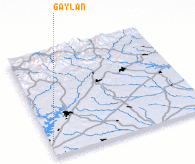 Places with similar names to Gay Lan, United States - USA ::
Disclaimer :: Information on this page comes without warranty of any kind |
||
|
Where is Gay Lan? Elevation and coordinates ::
Latitude (lat): 34°9'47"N Longitude (lon): 83°58'35"W
Elevation (approx.): 358m (map arrows pan, magnifying glasses zoom) |
||
|
Visiting Gay Lan? Hotel/Accommodation ::
Book a hotel in Gay Lan Travel Guide ::
rental cars ::
car rental offers GPS waypoint ::
download a GPX waypoint (PoI) of Gay Lan for your GPS receiver
|
||