|
search place name
|
||
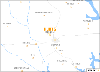
Hunts (Georgia, United States - USA)Hunts is a town in the Georgia region of United States - USA. An overview map of the region around Hunts is displayed below.
regional and 3d topo map of Hunts, United States - USA ::
Hunts airports ::
The nearest airport is MCN - Macon Middle Georgia Rgnl, located 75.3 km south of Hunts.
Other airports nearby include WRB - Macon Robins Afb (79.6 km south), ATL - Hartsfield Jackson Atlanta Intl (100.5 km west), MGE - Marietta Dobbins Arb (Atlanta Nas) (121.2 km north west), AGS - Bush Field Augusta Rgnl At Bush Fld (134.2 km east), Nearby towns ::
 Places with similar names to Hunts, United States - USA ::
Disclaimer :: Information on this page comes without warranty of any kind |
||
|
Where is Hunts? Elevation and coordinates ::
Latitude (lat): 33°20'25"N Longitude (lon): 83°24'21"W
Elevation (approx.): 174m (map arrows pan, magnifying glasses zoom) |
||
|
Visiting Hunts? Hotel/Accommodation ::
Book a hotel in Hunts Travel Guide ::
rental cars ::
car rental offers GPS waypoint ::
download a GPX waypoint (PoI) of Hunts for your GPS receiver
|
||