|
search place name
|
||
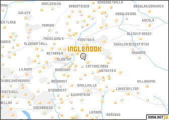
Inglenook (Georgia, United States - USA)Inglenook is a town in the Georgia region of United States - USA. An overview map of the region around Inglenook is displayed below.
regional and 3d topo map of Inglenook, United States - USA ::
Inglenook airports ::
The nearest airport is MGE - Marietta Dobbins Arb (Atlanta Nas), located 45.3 km west of Inglenook.
Other airports nearby include ATL - Hartsfield Jackson Atlanta Intl (48.6 km south west), AND - Andersen Anderson Rgnl (137.2 km north east), MCN - Macon Middle Georgia Rgnl (140.4 km south), WRB - Macon Robins Afb (147.4 km south), Nearby towns ::
Bristol Downs (0.8km south east) //
Flowers Crossing (1.5km south) //
Murphyville (2.1km north west) //
Cricket Hill (2.1km south west) //
Murphy Estates (2.3km north west) //
La Mancha (2.7km north west) //
River Bridge (2.4km west) //
Emerald Forest (2.8km south west) //
Castle Courts (2.8km north west) //
Fairfield Farms (3.2km south east) //
Summerville (3.3km north) //
Bridgewater (3.3km south) //
Yorktown (3.4km north) //
Coopers Pond (3.0km south west) //
Cotton Creek (3.5km south east) //
Ansley Brook (3.3km south west) //
Sweet Water (3.4km west) //
Brookwood Manor (4.3km south) //
Oakland North (3.9km north west) //
Gloster (3.7km west) //
Forest Hills (3.9km north east) //
Plantation Woods (4.4km north west) //
Five Forks (4.7km south west) //
Oakdale Woods (4.3km east) //
Timbercrest (4.4km east) //
Graystone North (5.1km south east) //
Carmel East (4.7km east) //
River Oak (5.1km south west) //
Lawrenceville (5.5km north east) //
[all distances 'as the bird flies' and approximate]  Places with similar names to Inglenook, United States - USA ::
Disclaimer :: Information on this page comes without warranty of any kind |
||
|
Where is Inglenook? Elevation and coordinates ::
Latitude (lat): 33°55'6"N Longitude (lon): 84°1'36"W
Elevation (approx.): 305m (map arrows pan, magnifying glasses zoom) |
||
|
Visiting Inglenook? Hotel/Accommodation ::
Book a hotel in Inglenook Travel Guide ::
rental cars ::
car rental offers GPS waypoint ::
download a GPX waypoint (PoI) of Inglenook for your GPS receiver
|
||