|
search place name
|
||
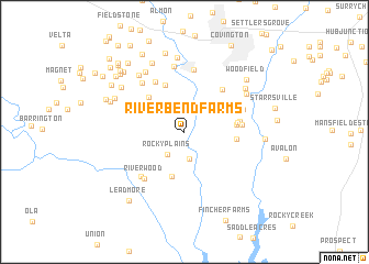
Riverbend Farms (Georgia, United States - USA)Riverbend Farms is a town in the Georgia region of United States - USA. An overview map of the region around Riverbend Farms is displayed below.
regional and 3d topo map of Riverbend Farms, United States - USA ::
Riverbend Farms airports ::
The nearest airport is ATL - Hartsfield Jackson Atlanta Intl, located 50.5 km west of Riverbend Farms.
Other airports nearby include MGE - Marietta Dobbins Arb (Atlanta Nas) (71.9 km north west), MCN - Macon Middle Georgia Rgnl (94.5 km south), WRB - Macon Robins Afb (101.6 km south), AND - Andersen Anderson Rgnl (154.5 km north east), Nearby towns ::
Springhill (2.3km north west) //
Creekwood Estates (2.7km south) //
Rocky Plains (2.7km south west) //
Hollow Oaks (4.7km south) //
Lakeside (4.6km north west) //
Rogers Heights (5.0km north) //
Highpoint Forest (4.4km east) //
Lassiter (4.4km east) //
Highpoint Mobile Home Park (4.7km east) //
High Point (4.8km east) //
Hidden Pines (5.4km north east) //
Knights Landing (5.6km north west) //
Pine Valley Mobile Home Park (4.9km east) //
Country Acres Mobile Home Park (5.2km north west) //
Riverwood (5.8km south west) //
Riverside Park (5.8km south west) //
Anderson Acres (5.5km north east) //
Porterdale (6.4km north) //
Forest Mill (6.1km north west) //
River North (6.7km north) //
Fox Meadows (6.9km north west) //
Country Terrace (6.9km north west) //
Alcovy Mobile Home Park (6.5km north east) //
Newton Woods (7.5km north) //
Cedar Creek (6.8km north east) //
Brown Bridge Square (7.5km north) //
Forest Lakes (6.8km north west) //
Country Wood (7.0km north west) //
Oak Hill Farms (7.0km north west) //
[all distances 'as the bird flies' and approximate] 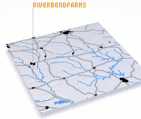 Places with similar names to Riverbend Farms, United States - USA :: Disclaimer :: Information on this page comes without warranty of any kind |
||
|
Where is Riverbend Farms? Elevation and coordinates ::
Latitude (lat): 33°31'5"N Longitude (lon): 83°54'10"W
Elevation (approx.): 194m (map arrows pan, magnifying glasses zoom) |
||
|
Visiting Riverbend Farms? Hotel/Accommodation ::
Book a hotel in Riverbend Farms Travel Guide ::
rental cars ::
car rental offers GPS waypoint ::
download a GPX waypoint (PoI) of Riverbend Farms for your GPS receiver
|
||