|
search place name
|
||
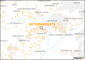
Skyview Heights (Georgia, United States - USA)Skyview Heights is a town in the Georgia region of United States - USA. An overview map of the region around Skyview Heights is displayed below.
regional and 3d topo map of Skyview Heights, United States - USA ::
Skyview Heights airports ::
The nearest airport is MGE - Marietta Dobbins Arb (Atlanta Nas), located 19.2 km north east of Skyview Heights.
Other airports nearby include ATL - Hartsfield Jackson Atlanta Intl (26.5 km south east), ANB - Anniston Metro (113.9 km west), CHA - Chattanooga Lovell Fld (147.7 km north), MCN - Macon Middle Georgia Rgnl (153.0 km south east), Nearby towns ::
Heritage Square (0.5km north east) //
Forest Acres (0.9km south east) //
North Kingsley Estates (0.9km north east) //
Brookwood Acres (1.0km south west) //
Beechwood Hills (1.2km south east) //
Lithia Springs (1.2km north west) //
Skyview (1.3km south east) //
Brannons Branch (1.2km east) //
Whitaker Hills (1.3km west) //
Ansley Park (1.7km north west) //
Tammy Heights (1.6km west) //
Oak Hill (1.8km north west) //
Deerfield (1.8km south east) //
Lithia Mobile Home Estates (1.9km south west) //
Anna Bella Estates (2.3km north west) //
Rocky Hills (2.2km west) //
Park Place (2.7km south) //
Brookstone (2.8km south) //
Boulder Park Estates (2.5km west) //
Springtime Mobile Home Park (2.6km south west) //
Lawrence Estates (2.8km north east) //
Leeward Park (3.1km south) //
Trail Creek (3.2km south) //
Lake Estates (3.2km south) //
Lakeside Mobile Home Park (2.7km west) //
Brook Forest Mobile Home Park (3.0km north east) //
Park Forest (2.8km west) //
Beech Gum Mobile Home Park (3.1km north east) //
Falcon Acres (3.3km north west) //
[all distances 'as the bird flies' and approximate]  Places with similar names to Skyview Heights, United States - USA :: Disclaimer :: Information on this page comes without warranty of any kind |
||
|
Where is Skyview Heights? Elevation and coordinates ::
Latitude (lat): 33°47'5"N Longitude (lon): 84°39'10"W
Elevation (approx.): 312m (map arrows pan, magnifying glasses zoom) |
||
|
Visiting Skyview Heights? Hotel/Accommodation ::
Book a hotel in Skyview Heights Travel Guide ::
rental cars ::
car rental offers GPS waypoint ::
download a GPX waypoint (PoI) of Skyview Heights for your GPS receiver
|
||