|
search place name
|
||
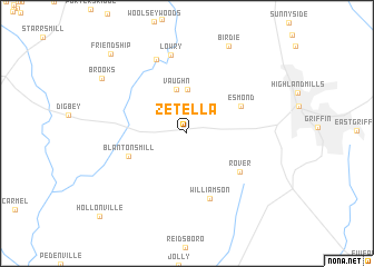
Zetella (Georgia, United States - USA)Zetella is a town in the Georgia region of United States - USA. An overview map of the region around Zetella is displayed below.
regional and 3d topo map of Zetella, United States - USA ::
Zetella airports ::
The nearest airport is ATL - Hartsfield Jackson Atlanta Intl, located 44.1 km north of Zetella.
Other airports nearby include MGE - Marietta Dobbins Arb (Atlanta Nas) (75.8 km north), MCN - Macon Middle Georgia Rgnl (91.6 km south east), WRB - Macon Robins Afb (99.5 km south east), LSF - Fort Benning Lawson Aaf (115.3 km south west), Nearby towns ::
Rio (4.4km north) //
Vaughn (4.5km north) //
Esmond (5.3km north east) //
Blantons Mill (5.4km south west) //
Rover (5.8km south east) //
Williamson (6.8km south) //
Lowry (8.0km north) //
Cambridge Estates (7.9km north) //
Birdie (9.4km north) //
Brooks (9.1km north west) //
Friendship (10.2km north west) //
Hollonville (11.1km south west) //
[all distances 'as the bird flies' and approximate] 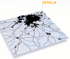 Places with similar names to Zetella, United States - USA ::
Disclaimer :: Information on this page comes without warranty of any kind |
||
|
Where is Zetella? Elevation and coordinates ::
Latitude (lat): 33°14'27"N Longitude (lon): 84°22'56"W
Elevation (approx.): 264m (map arrows pan, magnifying glasses zoom) |
||
|
Visiting Zetella? Hotel/Accommodation ::
Book a hotel in Zetella Travel Guide ::
rental cars ::
car rental offers GPS waypoint ::
download a GPX waypoint (PoI) of Zetella for your GPS receiver
|
||