|
search place name
|
||
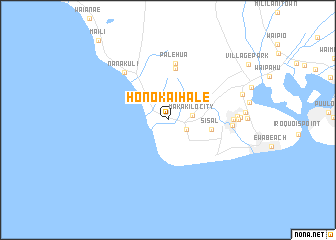
Honokai Hale (Hawaii, United States - USA)Honokai Hale is a town in the Hawaii region of United States - USA. An overview map of the region around Honokai Hale is displayed below.
regional and 3d topo map of Honokai Hale, United States - USA ::
Honokai Hale airports ::
The nearest airport is HNL - Honolulu Intl (Hickam Afb), located 19.7 km east of Honokai Hale.
Other airports nearby include HDH - Dillingham (27.7 km north), NGF - Kaneohe Bay Mcaf (37.5 km east), MKK - Molokai (107.4 km east), LNY - Lanai (135.4 km south east), Nearby towns ::
Waimanalo Village (2.2km south east) //
Makakilo City (2.6km east) //
Sisal (4.7km east) //
Akupu (5.8km north) //
Palehua (6.4km north) //
Nanakuli (7.0km north west) //
Varona Village (6.8km east) //
Tenney Village (6.8km east) //
Ewa Villages (7.3km east) //
Ewa (7.3km east) //
Renton Village (7.6km east) //
Fernandez Village (8.1km east) //
Honouliuli (8.2km east) //
Ewa Gentry (8.3km east) //
Maili (11.4km north west) //
[all distances 'as the bird flies' and approximate]  Places with similar names to Honokai Hale, United States - USA ::
// Honk Hill (US)
Disclaimer :: Information on this page comes without warranty of any kind |
||
|
Where is Honokai Hale? Elevation and coordinates ::
Latitude (lat): 21°20'33"N Longitude (lon): 158°6'39"W
Elevation (approx.): 45m (map arrows pan, magnifying glasses zoom) |
||
|
Visiting Honokai Hale? Hotel/Accommodation ::
Book a hotel in Honokai Hale Travel Guide ::
rental cars ::
car rental offers GPS waypoint ::
download a GPX waypoint (PoI) of Honokai Hale for your GPS receiver
|
||