|
search place name
|
||
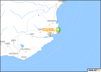
Niumalu (Hawaii, United States - USA)Niumalu is a town in the Hawaii region of United States - USA. An overview map of the region around Niumalu is displayed below.
regional and 3d topo map of Niumalu, United States - USA ::
Niumalu airports ::
The nearest airport is LIH - Lihue, located 3.5 km north east of Niumalu.
Other airports nearby include BKH - Barking Sands Pmrf (44.0 km west), HDH - Dillingham (127.7 km east), HNL - Honolulu Intl (Hickam Afb) (165.1 km south east), NGF - Kaneohe Bay Mcaf (174.4 km east), Nearby towns ::
Kupolo (1.4km north) //
Ulu Ko (1.4km north west) //
Nawiliwili (1.5km north east) //
Ulu Mahi (1.8km north west) //
Pua Loke (2.2km north west) //
Lihue (2.9km north) //
Puhi (3.8km north west) //
Kapaia (4.3km north) //
Hanamaulu (4.8km north) //
Kipu (6.4km west) //
[all distances 'as the bird flies' and approximate] 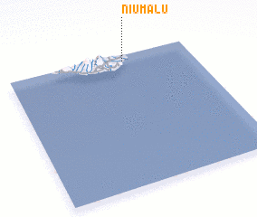 Places with similar names to Niumalu, United States - USA ::
Disclaimer :: Information on this page comes without warranty of any kind |
||
|
Where is Niumalu? Elevation and coordinates ::
Latitude (lat): 21°57'19"N Longitude (lon): 159°21'54"W
Elevation (approx.): 18m (map arrows pan, magnifying glasses zoom) |
||
|
Visiting Niumalu? Hotel/Accommodation ::
Book a hotel in Niumalu Travel Guide ::
rental cars ::
car rental offers GPS waypoint ::
download a GPX waypoint (PoI) of Niumalu for your GPS receiver
|
||