|
search place name
|
||
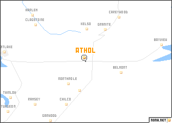
Athol (Idaho, United States - USA)Athol is a town in the Idaho region of United States - USA. An overview map of the region around Athol is displayed below.
regional and 3d topo map of Athol, United States - USA ::
Athol airports ::
The nearest airport is SFF - Spokane Felts Fld, located 54.7 km south west of Athol.
Other airports nearby include GEG - Spokane Intl (71.9 km south west), SKA - Spokane Fairchild Afb (80.2 km south west), YCG - Castlegar (164.7 km north west), YXC - Cranbrook (197.0 km north), Nearby towns ::
North Pole (5.5km south west) //
Corbin Junction (6.4km south) //
Kelso (7.1km north) //
Belmont (5.6km south east) //
Granite (7.5km north) //
[all distances 'as the bird flies' and approximate]  Places with similar names to Athol, United States - USA ::
Disclaimer :: Information on this page comes without warranty of any kind |
||
|
Where is Athol? Elevation and coordinates ::
Latitude (lat): 47°56'53"N Longitude (lon): 116°42'25"W
Elevation (approx.): 729m (map arrows pan, magnifying glasses zoom) |
||
|
Visiting Athol? Hotel/Accommodation ::
Book a hotel in Athol Travel Guide ::
rental cars ::
car rental offers GPS waypoint ::
download a GPX waypoint (PoI) of Athol for your GPS receiver
|
||