|
search place name
|
||
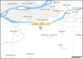
Coal Valley (Illinois, United States - USA)Coal Valley is a town in the Illinois region of United States - USA. An overview map of the region around Coal Valley is displayed below.
regional and 3d topo map of Coal Valley, United States - USA ::
Coal Valley airports ::
The nearest airport is MSN - Madison Dane Co Rgnl Truax Fld, located 211.5 km north east of Coal Valley.
Nearby towns ::
Poplar Grove (3.3km north) //
Sunny Hill Estates (4.5km south east) //
Sunny Hill (5.0km south east) //
Bridgeway Addition (6.1km north west) //
Fruitland (6.7km north west) //
East Moline (8.1km north) //
Moline (9.8km north west) //
Carbon Cliff (9.4km north east) //
Orion (10.6km south east) //
[all distances 'as the bird flies' and approximate]  Places with similar names to Coal Valley, United States - USA ::
// Coal Valley (US)
// Galeyville (US)
// Quail Valley (US)
// Cooleyville (US)
// Quail Valley (US)
// Calville (US)
// Coleville (US)
// Clayville (US)
// Quail Valley (US)
// Quail Valley (US)
Disclaimer :: Information on this page comes without warranty of any kind |
||
|
Where is Coal Valley? Elevation and coordinates ::
Latitude (lat): 41°25'43"N Longitude (lon): 90°27'39"W
Elevation (approx.): 193m (map arrows pan, magnifying glasses zoom) |
||
|
Visiting Coal Valley? Hotel/Accommodation ::
Book a hotel in Coal Valley Travel Guide ::
rental cars ::
car rental offers GPS waypoint ::
download a GPX waypoint (PoI) of Coal Valley for your GPS receiver
|
||