|
search place name
|
||
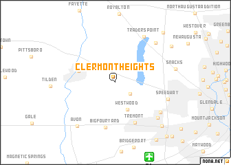
Clermont Heights (Indiana, United States - USA)Clermont Heights is a town in the Indiana region of United States - USA. An overview map of the region around Clermont Heights is displayed below.
regional and 3d topo map of Clermont Heights, United States - USA ::
Clermont Heights airports ::
The nearest airport is IND - Indianapolis Intl, located 12.9 km south of Clermont Heights.
Other airports nearby include HUF - Terre Haute Intl Hulman Fld (92.6 km south west), GUS - Peru Grissom Arb (92.7 km north), CVG - Cincinnati Northern Kentucky Intl (168.2 km south east), LUK - Cincinnati Muni Lunken Fld (184.1 km south east), Nearby towns ::
Clermont (2.6km south east) //
Westwood (4.7km south) //
Brownsburg (4.9km west) //
Tremont (7.0km south) //
Big Four Yard (7.4km south) //
Farleys Addition (7.4km south east) //
Traders Point (8.2km north east) //
Speedway (7.1km east) //
Chapel Hill (7.8km south east) //
Lakeside (8.1km north east) //
Avon (8.5km south west) //
Keystone Manor (9.1km south east) //
Northwest Manor (10.0km north east) //
Ben Davis (10.8km south east) //
[all distances 'as the bird flies' and approximate] 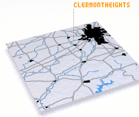 Places with similar names to Clermont Heights, United States - USA ::
// Clermont Heights (US)
Disclaimer :: Information on this page comes without warranty of any kind |
||
|
Where is Clermont Heights? Elevation and coordinates ::
Latitude (lat): 39°49'36"N Longitude (lon): 86°20'39"W
Elevation (approx.): 268m (map arrows pan, magnifying glasses zoom) |
||
|
Visiting Clermont Heights? Hotel/Accommodation ::
Book a hotel in Clermont Heights Travel Guide ::
rental cars ::
car rental offers GPS waypoint ::
download a GPX waypoint (PoI) of Clermont Heights for your GPS receiver
|
||