|
search place name
|
||
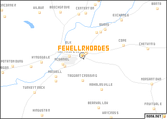
Fewell Rhoades (Indiana, United States - USA)Fewell Rhoades is a town in the Indiana region of United States - USA. An overview map of the region around Fewell Rhoades is displayed below.
regional and 3d topo map of Fewell Rhoades, United States - USA ::
Fewell Rhoades airports ::
The nearest airport is IND - Indianapolis Intl, located 34.1 km north of Fewell Rhoades.
Other airports nearby include HUF - Terre Haute Intl Hulman Fld (78.3 km west), GUS - Peru Grissom Arb (137.8 km north), LOU - Louisville Bowman Fld (147.1 km south east), CVG - Cincinnati Northern Kentucky Intl (155.1 km east), Nearby towns ::
Wolff (1.3km north) //
Shelburne (1.6km north) //
Woodcrest (1.8km north) //
Martinsville (2.6km west) //
Elk (3.7km north west) //
Champlin Meadows (3.6km south west) //
Taggart Crossing (4.7km south) //
McDaniel (3.7km west) //
Stines Mill Corner (6.5km north) //
Maxwell (6.1km south west) //
Willowbrook Estates (6.9km north east) //
Prather (6.8km south west) //
Mahalasville (7.5km south east) //
Adams (7.7km north east) //
[all distances 'as the bird flies' and approximate] 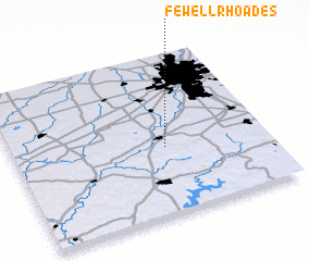 Places with similar names to Fewell Rhoades, United States - USA :: Disclaimer :: Information on this page comes without warranty of any kind |
||
|
Where is Fewell Rhoades? Elevation and coordinates ::
Latitude (lat): 39°25'17"N Longitude (lon): 86°23'58"W
Elevation (approx.): 211m (map arrows pan, magnifying glasses zoom) |
||
|
Visiting Fewell Rhoades? Hotel/Accommodation ::
Book a hotel in Fewell Rhoades Travel Guide ::
rental cars ::
car rental offers GPS waypoint ::
download a GPX waypoint (PoI) of Fewell Rhoades for your GPS receiver
|
||