|
search place name
|
||
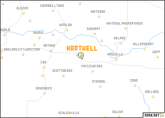
Hartwell (Indiana, United States - USA)Hartwell is a town in the Indiana region of United States - USA. An overview map of the region around Hartwell is displayed below.
regional and 3d topo map of Hartwell, United States - USA ::
Hartwell airports ::
The nearest airport is FTK - Fort Knox Godman Aaf, located 115.5 km south east of Hartwell.
Other airports nearby include HUF - Terre Haute Intl Hulman Fld (125.8 km north), LOU - Louisville Bowman Fld (133.1 km east), IND - Indianapolis Intl (172.8 km north east), HOP - Hopkinsville Campbell Aaf (185.7 km south), Nearby towns ::
Augusta (1.4km north west) //
Fritz Corner (3.3km south east) //
Scottsburg (5.1km south west) //
Hartwell Junction (5.4km north east) //
Survant (6.1km north) //
Stendal (6.9km south east) //
Winslow (7.2km north west) //
Pikeville (6.0km east) //
Arthur (6.1km west) //
Ayrshire (7.7km north west) //
Coe (7.1km west) //
Velpen (7.7km north east) //
Spurgeon (10.3km south west) //
[all distances 'as the bird flies' and approximate] 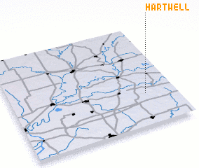 Places with similar names to Hartwell, United States - USA ::
Disclaimer :: Information on this page comes without warranty of any kind |
||
|
Where is Hartwell? Elevation and coordinates ::
Latitude (lat): 38°19'21"N Longitude (lon): 87°10'47"W
Elevation (approx.): 187m (map arrows pan, magnifying glasses zoom) |
||
|
Visiting Hartwell? Hotel/Accommodation ::
Book a hotel in Hartwell Travel Guide ::
rental cars ::
car rental offers GPS waypoint ::
download a GPX waypoint (PoI) of Hartwell for your GPS receiver
|
||