|
search place name
|
||
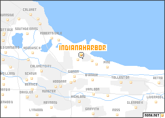
Indiana Harbor (Indiana, United States - USA)Indiana Harbor is a town in the Indiana region of United States - USA. An overview map of the region around Indiana Harbor is displayed below.
regional and 3d topo map of Indiana Harbor, United States - USA ::
Indiana Harbor airports ::
The nearest airport is MDW - Chicago Midway Intl, located 30.2 km north west of Indiana Harbor.
Other airports nearby include ORD - Chicago Ohare Intl (53.6 km north west), IKK - Greater Kankakee (71.6 km south west), MKE - Milwaukee General Mitchell Intl (149.8 km north), GUS - Peru Grissom Arb (154.7 km south east), Nearby towns ::
East Chicago (0.8km west) //
Buffington (1.7km east) //
Clarke Junction (2.7km south east) //
Gibson (4.1km south) //
Ivanhoe (5.1km south) //
Hessville (5.2km south) //
Osborn (5.7km south) //
Pine (4.6km south east) //
Whiting (6.0km north west) //
Woodmar (7.2km south west) //
Van Loon (8.2km south) //
Robertsdale (7.0km north west) //
Hammond (7.8km south west) //
Black Oak (9.3km south east) //
Tolleston (8.4km south east) //
Munster (10.1km south west) //
[all distances 'as the bird flies' and approximate] 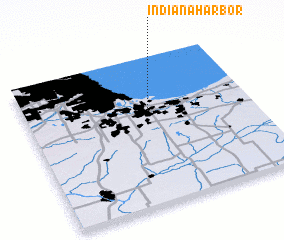 Places with similar names to Indiana Harbor, United States - USA ::
Disclaimer :: Information on this page comes without warranty of any kind |
||
|
Where is Indiana Harbor? Elevation and coordinates ::
Latitude (lat): 41°38'26"N Longitude (lon): 87°26'43"W
Elevation (approx.): 181m (map arrows pan, magnifying glasses zoom) |
||
|
Visiting Indiana Harbor? Hotel/Accommodation ::
Book a hotel in Indiana Harbor Travel Guide ::
rental cars ::
car rental offers GPS waypoint ::
download a GPX waypoint (PoI) of Indiana Harbor for your GPS receiver
|
||