|
search place name
|
||
Knightstown (Indiana, United States - USA)Knightstown is a town in the Indiana region of United States - USA. An overview map of the region around Knightstown is displayed below.
regional and 3d topo map of Knightstown, United States - USA ::

Knightstown airports ::
The nearest airport is IND - Indianapolis Intl, located 66.4 km west of Knightstown.
Other airports nearby include GUS - Peru Grissom Arb (108.6 km north west), CVG - Cincinnati Northern Kentucky Intl (111.1 km south east), DAY - James M Cox Dayton Intl (112.5 km east), LUK - Cincinnati Muni Lunken Fld (122.5 km south east), Nearby towns ::
Raysville (1.2km east) //
Sulphur Spring (3.0km south) //
Knox (3.3km north west) //
Ogden (4.9km east) //
Henry (5.3km west) //
Stone Quarry Mills (6.7km north east) //
Grant City (8.0km north) //
Carthage (7.5km south west) //
Boyd (8.8km south) //
Maple Valley (9.5km north west) //
Greensboro (10.2km north east) //
[all distances 'as the bird flies' and approximate] 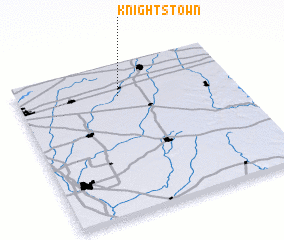 Places with similar names to Knightstown, United States - USA ::
// Nuevo Destino (BO)
// Knights Town (IE)
// Novo Destino (BR)
// Novo Destino (BR)
// Novo Destino (BR)
Disclaimer :: Information on this page comes without warranty of any kind |
||
|
Where is Knightstown? Elevation and coordinates ::
Latitude (lat): 39°47'44"N Longitude (lon): 85°31'35"W
Elevation (approx.): 286m (map arrows pan, magnifying glasses zoom) |
||
|
Visiting Knightstown? Hotel/Accommodation ::
Book a hotel in Knightstown Travel Guide ::
rental cars ::
car rental offers GPS waypoint ::
download a GPX waypoint (PoI) of Knightstown for your GPS receiver
|
||