|
search place name
|
||
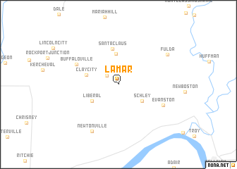
Lamar (Indiana, United States - USA)Lamar is a town in the Indiana region of United States - USA. An overview map of the region around Lamar is displayed below.
regional and 3d topo map of Lamar, United States - USA ::
Lamar airports ::
The nearest airport is FTK - Fort Knox Godman Aaf, located 84.0 km east of Lamar.
Other airports nearby include LOU - Louisville Bowman Fld (110.3 km east), HUF - Terre Haute Intl Hulman Fld (157.4 km north), HOP - Hopkinsville Campbell Aaf (164.0 km south), IND - Indianapolis Intl (190.5 km north), Nearby towns ::
Kennedy (2.0km north west) //
Schley (3.9km south east) //
Santa Fe (4.8km north) //
Liberal (4.2km south west) //
Clay City (4.3km west) //
Santa Claus (5.7km north) //
Buffaloville (6.1km north west) //
Evanston (6.5km south east) //
Newtonville (8.2km south west) //
Fulda (7.7km north east) //
[all distances 'as the bird flies' and approximate] 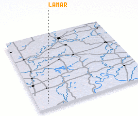 Places with similar names to Lamar, United States - USA ::
Disclaimer :: Information on this page comes without warranty of any kind |
||
|
Where is Lamar? Elevation and coordinates ::
Latitude (lat): 38°4'9"N Longitude (lon): 86°54'20"W
Elevation (approx.): 125m (map arrows pan, magnifying glasses zoom) |
||
|
Visiting Lamar? Hotel/Accommodation ::
Book a hotel in Lamar Travel Guide ::
rental cars ::
car rental offers GPS waypoint ::
download a GPX waypoint (PoI) of Lamar for your GPS receiver
|
||