|
search place name
|
||
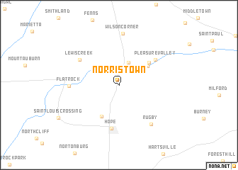
Norristown (Indiana, United States - USA)Norristown is a town in the Indiana region of United States - USA. An overview map of the region around Norristown is displayed below.
regional and 3d topo map of Norristown, United States - USA ::
Norristown airports ::
The nearest airport is IND - Indianapolis Intl, located 60.3 km north west of Norristown.
Other airports nearby include CVG - Cincinnati Northern Kentucky Intl (100.7 km east), LUK - Cincinnati Muni Lunken Fld (119.5 km east), LOU - Louisville Bowman Fld (126.5 km south), HUF - Terre Haute Intl Hulman Fld (133.6 km west), Nearby towns ::
Camp Flat Rock (3.7km north) //
Geneva (4.6km north east) //
Old Saint Louis (5.4km south west) //
Sleepy Hollow (5.1km north east) //
Hope (6.9km south) //
Pleasure Valley (6.0km north east) //
Lewis Creek (6.3km north west) //
Flat Rock (6.1km west) //
Rugby (7.4km south east) //
Wilson Corner (8.1km north) //
[all distances 'as the bird flies' and approximate] 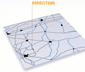 Places with similar names to Norristown, United States - USA ::
// Norristown (US)
// Norristown (US)
// Norristown (US)
// Nārastān (IN)
// Nārestān (IR)
// Nārestān (IR)
// Nārestān (IR)
// Nārestāneh (IR)
// Nahr-e Sa‘dūnī (IR)
// Nor Zeytʼun (AM)
Disclaimer :: Information on this page comes without warranty of any kind |
||
|
Where is Norristown? Elevation and coordinates ::
Latitude (lat): 39°21'55"N Longitude (lon): 85°45'38"W
Elevation (approx.): 230m (map arrows pan, magnifying glasses zoom) |
||
|
Visiting Norristown? Hotel/Accommodation ::
Book a hotel in Norristown Travel Guide ::
rental cars ::
car rental offers GPS waypoint ::
download a GPX waypoint (PoI) of Norristown for your GPS receiver
|
||