|
search place name
|
||
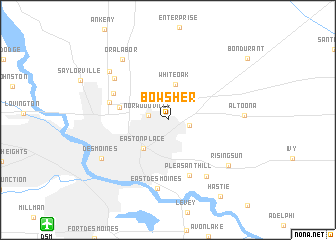
Bowsher (Iowa, United States - USA)Bowsher is a town in the Iowa region of United States - USA. An overview map of the region around Bowsher is displayed below.
regional and 3d topo map of Bowsher, United States - USA ::
Bowsher airports ::
The nearest airport is DSM - Des Moines Intl, located 15.5 km south west of Bowsher.
Other airports nearby include FOD - Fort Dodge Rgnl (114.7 km north west), Nearby towns ::
Norwoodville (1.7km west) //
Capitol Heights (1.9km east) //
Berwick (2.9km north) //
White Oak (4.0km north) //
Easton Place (3.8km south west) //
Swanwood (4.3km west) //
Pleasant Hill (6.4km south) //
Saylor (5.4km north west) //
Marquisville (5.3km west) //
Saylor Station (6.4km north west) //
Carbondale (7.1km south east) //
East Des Moines (7.6km south) //
Rising Sun (7.1km south east) //
Oralabor (7.8km north west) //
Carney (7.3km north west) //
Altoona (6.4km east) //
Des Moines (7.0km south west) //
Hastie (9.5km south east) //
Bondurant (9.5km north east) //
[all distances 'as the bird flies' and approximate] 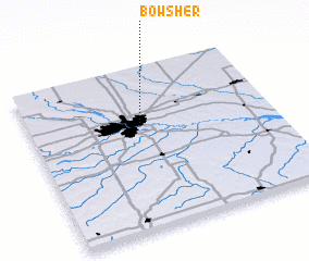 Places with similar names to Bowsher, United States - USA ::
Disclaimer :: Information on this page comes without warranty of any kind |
||
|
Where is Bowsher? Elevation and coordinates ::
Latitude (lat): 41°38'21"N Longitude (lon): 93°32'30"W
Elevation (approx.): 249m (map arrows pan, magnifying glasses zoom) |
||
|
Visiting Bowsher? Hotel/Accommodation ::
Book a hotel in Bowsher Travel Guide ::
rental cars ::
car rental offers GPS waypoint ::
download a GPX waypoint (PoI) of Bowsher for your GPS receiver
|
||