|
search place name
|
||
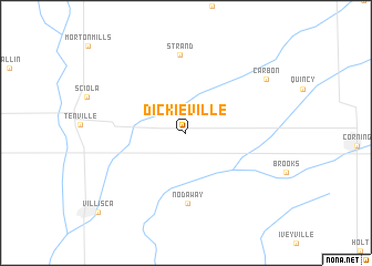
Dickieville (Iowa, United States - USA)Dickieville is a town in the Iowa region of United States - USA. An overview map of the region around Dickieville is displayed below.
regional and 3d topo map of Dickieville, United States - USA ::
Dickieville airports ::
The nearest airport is OFF - Omaha Offutt Afb, located 86.4 km west of Dickieville.
Other airports nearby include OMA - Omaha Eppley Afld (90.3 km west), DSM - Des Moines Intl (119.0 km north east), LNK - Lincoln (157.8 km west), FLV - Fort Leavenworth Sherman Aaf (181.3 km south), Nearby towns ::
 Places with similar names to Dickieville, United States - USA ::
// Dickeyville (US)
// Digueifel (PT)
// Dickvale (US)
// Dickeyville (US)
// Duckville (US)
// Teckville (US)
// Dukeville (US)
// Dickville (US)
// Dogafoley (TD)
// Digvala (IN)
Disclaimer :: Information on this page comes without warranty of any kind |
||
|
Where is Dickieville? Elevation and coordinates ::
Latitude (lat): 41°0'4"N Longitude (lon): 94°53'45"W
Elevation (approx.): 364m (map arrows pan, magnifying glasses zoom) |
||
|
Visiting Dickieville? Hotel/Accommodation ::
Book a hotel in Dickieville Travel Guide ::
rental cars ::
car rental offers GPS waypoint ::
download a GPX waypoint (PoI) of Dickieville for your GPS receiver
|
||