|
search place name
|
||
Walnut City (Iowa, United States - USA)Walnut City is a town in the Iowa region of United States - USA. An overview map of the region around Walnut City is displayed below.
regional and 3d topo map of Walnut City, United States - USA ::

Walnut City airports ::
The nearest airport is DSM - Des Moines Intl, located 100.3 km north west of Walnut City.
Other airports nearby include FOD - Fort Dodge Rgnl (219.3 km north west), MCI - Kansas City Intl (226.0 km south west), COU - Columbia Rgnl (229.9 km south), FLV - Fort Leavenworth Sherman Aaf (232.2 km south west), Nearby towns ::
Mystic (3.9km south) //
Clarkdale (4.5km south east) //
Diamond (5.7km south) //
Brazil (6.1km south) //
Rathbun (4.9km east) //
Garfield (6.8km south west) //
Darbyville (6.0km east) //
Sunshine (8.2km south) //
Iconium (8.8km north) //
Forbush (7.5km south east) //
Centerville (10.5km south east) //
[all distances 'as the bird flies' and approximate] 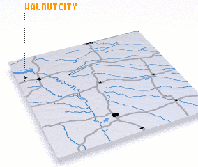 Places with similar names to Walnut City, United States - USA :: Disclaimer :: Information on this page comes without warranty of any kind |
||
|
Where is Walnut City? Elevation and coordinates ::
Latitude (lat): 40°48'44"N Longitude (lon): 92°56'41"W
Elevation (approx.): 303m (map arrows pan, magnifying glasses zoom) |
||
|
Visiting Walnut City? Hotel/Accommodation ::
Book a hotel in Walnut City Travel Guide ::
rental cars ::
car rental offers GPS waypoint ::
download a GPX waypoint (PoI) of Walnut City for your GPS receiver
|
||