|
search place name
|
||
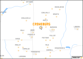
Croweburg (Kansas, United States - USA)Croweburg is a town in the Kansas region of United States - USA. An overview map of the region around Croweburg is displayed below.
regional and 3d topo map of Croweburg, United States - USA ::
Croweburg airports ::
The nearest airport is SZL - Knobnoster Whiteman Afb, located 163.0 km north east of Croweburg.
Other airports nearby include FOE - Topeka Forbes Fld (177.7 km north west), FYV - Fayetteville Drake Fld (177.8 km south), TUL - Tulsa Intl (186.0 km south west), MCI - Kansas City Intl (193.3 km north), Nearby towns ::
Barber (2.0km north east) //
Mertz (3.5km north east) //
Red Onion (3.8km north east) //
Arma (3.3km south west) //
Mulberry (3.9km east) //
Fox Town (5.1km south) //
Gross (5.1km north) //
Franklin (4.9km south west) //
Burgess (4.5km east) //
Curranville (5.7km south east) //
Fuller (5.6km south east) //
Coalvale (6.7km north) //
Englevale (6.8km north west) //
Yale (8.4km south) //
Polk (6.9km west) //
Ardath (8.0km north east) //
Dunkirk (10.5km south west) //
[all distances 'as the bird flies' and approximate] 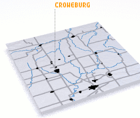 Places with similar names to Croweburg, United States - USA :: Disclaimer :: Information on this page comes without warranty of any kind |
||
|
Where is Croweburg? Elevation and coordinates ::
Latitude (lat): 37°33'25"N Longitude (lon): 94°39'57"W
Elevation (approx.): 279m (map arrows pan, magnifying glasses zoom) |
||
|
Visiting Croweburg? Hotel/Accommodation ::
Book a hotel in Croweburg Travel Guide ::
rental cars ::
car rental offers GPS waypoint ::
download a GPX waypoint (PoI) of Croweburg for your GPS receiver
|
||