|
search place name
|
||
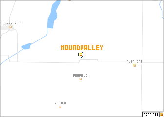
Mound Valley (Kansas, United States - USA)Mound Valley is a town in the Kansas region of United States - USA. An overview map of the region around Mound Valley is displayed below.
regional and 3d topo map of Mound Valley, United States - USA ::
Mound Valley airports ::
The nearest airport is TUL - Tulsa Intl, located 119.8 km south of Mound Valley.
Other airports nearby include IAB - Wichita Mc Connell Afb (171.3 km west), FYV - Fayetteville Drake Fld (173.0 km south east), FOE - Topeka Forbes Fld (195.1 km north), FSM - Fort Smith Rgnl (227.3 km south east), Nearby towns ::
Penfield (4.7km south) //
[all distances 'as the bird flies' and approximate]  Places with similar names to Mound Valley, United States - USA ::
// Montevallo (US)
// Moundville (US)
// Mandeville (US)
// Mandeville (US)
// Montivilla (US)
// Mandeville (US)
// Mountville (US)
// Mound Valley (US)
// Montevil (PT)
// Mantviliai (LT)
Disclaimer :: Information on this page comes without warranty of any kind |
||
|
Where is Mound Valley? Elevation and coordinates ::
Latitude (lat): 37°12'19"N Longitude (lon): 95°24'17"W
Elevation (approx.): 256m (map arrows pan, magnifying glasses zoom) |
||
|
Visiting Mound Valley? Hotel/Accommodation ::
Book a hotel in Mound Valley Travel Guide ::
rental cars ::
car rental offers GPS waypoint ::
download a GPX waypoint (PoI) of Mound Valley for your GPS receiver
|
||