|
search place name
|
||
Ashcamp (Kentucky, United States - USA)Ashcamp is a town in the Kentucky region of United States - USA. An overview map of the region around Ashcamp is displayed below.
regional and 3d topo map of Ashcamp, United States - USA ::

Ashcamp airports ::
The nearest airport is HKY - Hickory Rgnl, located 193.4 km south east of Ashcamp.
Other airports nearby include TYS - Knoxville Mc Ghee Tyson (213.4 km south west), LUK - Cincinnati Muni Lunken Fld (267.9 km north west), Nearby towns ::
Edgewater (3.3km north west) //
Blowing Rock (4.4km south) //
Hellier (4.0km north west) //
Skeetrock (5.3km south) //
Big Branch (5.7km north west) //
Lookout (6.0km north west) //
Henry Clay (6.2km north west) //
Rockhouse (6.9km north) //
Ramsey Flats (7.0km south) //
Dry Fork (7.2km north) //
Venters (7.3km north) //
Tivis (5.9km east) //
Tandy (7.5km south east) //
Ratliff (8.4km north) //
Dwale (8.7km south) //
Draffin (8.9km north) //
Isom (9.1km south) //
Dunleary (8.4km north east) //
Federal (8.3km north east) //
Beaver Bottom (8.5km north east) //
Belcher (10.0km north east) //
[all distances 'as the bird flies' and approximate] 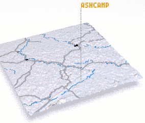 Places with similar names to Ashcamp, United States - USA :: Disclaimer :: Information on this page comes without warranty of any kind |
||
|
Where is Ashcamp? Elevation and coordinates ::
Latitude (lat): 37°15'58"N Longitude (lon): 82°26'6"W
Elevation (approx.): 344m (map arrows pan, magnifying glasses zoom) |
||
|
Visiting Ashcamp? Hotel/Accommodation ::
Book a hotel in Ashcamp Travel Guide ::
rental cars ::
car rental offers GPS waypoint ::
download a GPX waypoint (PoI) of Ashcamp for your GPS receiver
|
||