|
search place name
|
||
Binghamtown (Kentucky, United States - USA)Binghamtown is a town in the Kentucky region of United States - USA. An overview map of the region around Binghamtown is displayed below.
regional and 3d topo map of Binghamtown, United States - USA ::

Binghamtown airports ::
The nearest airport is TYS - Knoxville Mc Ghee Tyson, located 94.3 km south of Binghamtown.
Other airports nearby include CHA - Chattanooga Lovell Fld (222.1 km south west), LOU - Louisville Bowman Fld (246.9 km north west), Nearby towns ::
Middlesboro (2.6km south) //
Noetown (3.5km south west) //
Stony Fork Junction (4.3km south west) //
Meldrum (4.6km north east) //
Premier (5.5km south west) //
Edgewood (5.7km west) //
Tiprell (6.6km south east) //
Ferndale (7.9km north east) //
Yellow Creek (7.2km south west) //
Colmar (7.3km north east) //
Motch (7.8km south west) //
Harrogate (7.9km south east) //
Fork Ridge (9.0km south west) //
Patterson Crossroads (9.8km south east) //
[all distances 'as the bird flies' and approximate] 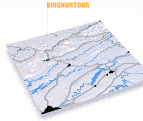 Places with similar names to Binghamtown, United States - USA ::
// Binghamtown (US)
// Binghamton (US)
// Ban Madan (TH)
// Ban Mae Ta Nai (TH)
// Ban Mae Tan Nua (TH)
// Ban Mae Ta Noi (TH)
// Ban Mae Ten (TH)
// Ban Mae Toen (TH)
// Ban Mae Tun (TH)
// Ban Mae Tun (TH)
Disclaimer :: Information on this page comes without warranty of any kind |
||
|
Where is Binghamtown? Elevation and coordinates ::
Latitude (lat): 36°37'53"N Longitude (lon): 83°43'16"W
Elevation (approx.): 347m (map arrows pan, magnifying glasses zoom) |
||
|
Visiting Binghamtown? Hotel/Accommodation ::
Book a hotel in Binghamtown Travel Guide ::
rental cars ::
car rental offers GPS waypoint ::
download a GPX waypoint (PoI) of Binghamtown for your GPS receiver
|
||