|
search place name
|
||
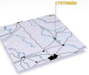
Cynthiana (Kentucky, United States - USA)Cynthiana is a town in the Kentucky region of United States - USA. An overview map of the region around Cynthiana is displayed below.
regional and 3d topo map of Cynthiana, United States - USA ::

Cynthiana airports ::
The nearest airport is LUK - Cincinnati Muni Lunken Fld, located 79.9 km north of Cynthiana.
Other airports nearby include CVG - Cincinnati Northern Kentucky Intl (80.0 km north west), LOU - Louisville Bowman Fld (121.1 km west), FTK - Fort Knox Godman Aaf (156.6 km west), FFO - Dayton Wright Patterson Afb (160.8 km north), Nearby towns ::
 Places with similar names to Cynthiana, United States - USA ::
// Sinthin (MM)
// Cynthiana (US)
// Cynthiana (US)
// Saint-Haon (FR)
// Say Yên Than (VN)
// Sen Thon (VN)
// Sin Than (VN)
// Sơn Thãnh (VN)
// Xuân Thôn (VN)
// Xuân Thành (VN)
Disclaimer :: Information on this page comes without warranty of any kind |
||
|
Where is Cynthiana? Elevation and coordinates ::
Latitude (lat): 38°23'25"N Longitude (lon): 84°17'39"W
Elevation (approx.): 220m (map arrows pan, magnifying glasses zoom) |
||
|
Visiting Cynthiana? Hotel/Accommodation ::
Book a hotel in Cynthiana Travel Guide ::
rental cars ::
car rental offers GPS waypoint ::
download a GPX waypoint (PoI) of Cynthiana for your GPS receiver
|
||