|
search place name
|
||
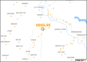
Douglas (Kentucky, United States - USA)Douglas is a town in the Kentucky region of United States - USA. An overview map of the region around Douglas is displayed below.
regional and 3d topo map of Douglas, United States - USA ::
Douglas airports ::
The nearest airport is HKY - Hickory Rgnl, located 209.1 km south east of Douglas.
Other airports nearby include TYS - Knoxville Mc Ghee Tyson (217.2 km south west), LUK - Cincinnati Muni Lunken Fld (252.2 km north west), Nearby towns ::
Robinson Creek (0.9km north east) //
Esco (1.6km south west) //
Yeager (2.3km north east) //
Penny (2.8km south west) //
Collins (3.3km north east) //
Pigeon (5.9km north) //
Virgie (5.9km south west) //
Fords Branch (6.6km north east) //
Yorktown (7.2km north) //
Ellwood (6.9km south west) //
Greasy Creek (5.9km east) //
Shelbiana (6.7km north east) //
Kewanee (7.5km north) //
Jonancy (7.9km south west) //
Mayo Village (8.3km north) //
Garden Village (8.2km north east) //
Henry Clay (9.5km south east) //
Big Branch (10.1km south east) //
Lookout (9.9km south east) //
[all distances 'as the bird flies' and approximate] 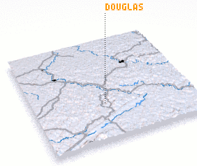 Places with similar names to Douglas, United States - USA ::
Disclaimer :: Information on this page comes without warranty of any kind |
||
|
Where is Douglas? Elevation and coordinates ::
Latitude (lat): 37°22'46"N Longitude (lon): 82°32'33"W
Elevation (approx.): 235m (map arrows pan, magnifying glasses zoom) |
||
|
Visiting Douglas? Hotel/Accommodation ::
Book a hotel in Douglas Travel Guide ::
rental cars ::
car rental offers GPS waypoint ::
download a GPX waypoint (PoI) of Douglas for your GPS receiver
|
||