|
search place name
|
||
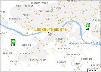
Lookout Heights (Kentucky, United States - USA)Lookout Heights is a town in the Kentucky region of United States - USA. An overview map of the region around Lookout Heights is displayed below.
regional and 3d topo map of Lookout Heights, United States - USA ::
Lookout Heights airports ::
The nearest airport is CVG - Cincinnati Northern Kentucky Intl, located 11.0 km west of Lookout Heights.
Other airports nearby include LUK - Cincinnati Muni Lunken Fld (11.5 km east), FFO - Dayton Wright Patterson Afb (94.4 km north east), DAY - James M Cox Dayton Intl (96.8 km north), LOU - Louisville Bowman Fld (134.9 km south west), Nearby towns ::
Fort Mitchell (0.9km south west) //
Park Hills (1.1km north east) //
Fort Wright (1.9km south east) //
Kenton Hills (2.1km north east) //
Bromley (2.2km north west) //
West Covington (2.5km north) //
Ludlow (2.8km north) //
South Fort Mitchell (3.1km south) //
Kenton Vale (2.8km south east) //
Lakeview (3.4km south) //
Covington (3.5km north east) //
Crescent Park (3.8km south west) //
Storrs (4.3km north) //
Latonia (3.7km south east) //
Sedamsville (3.9km north west) //
Lakeside Park (4.2km south west) //
Crescent Springs (3.7km south west) //
Sanfordtown (4.6km south) //
Winston Park (4.5km south east) //
Villa Hills (4.3km west) //
Forest Hills (4.9km south east) //
Mount Harrison (5.5km north) //
Saint Lawrence Corners (5.4km north west) //
Over-The-Rhine (5.5km north east) //
Newport (4.9km north east) //
Price Hill (5.5km north west) //
Maurice (6.1km south) //
Brighton Corner (6.2km north) //
Barrsville (6.3km north) //
[all distances 'as the bird flies' and approximate]  Places with similar names to Lookout Heights, United States - USA ::
// Logothétis (GR)
Disclaimer :: Information on this page comes without warranty of any kind |
||
|
Where is Lookout Heights? Elevation and coordinates ::
Latitude (lat): 39°4'2"N Longitude (lon): 84°32'36"W
Elevation (approx.): 260m (map arrows pan, magnifying glasses zoom) |
||
|
Visiting Lookout Heights? Hotel/Accommodation ::
Book a hotel in Lookout Heights Travel Guide ::
rental cars ::
car rental offers GPS waypoint ::
download a GPX waypoint (PoI) of Lookout Heights for your GPS receiver
|
||