|
search place name
|
||
Millville (Kentucky, United States - USA)Millville is a town in the Kentucky region of United States - USA. An overview map of the region around Millville is displayed below.
regional and 3d topo map of Millville, United States - USA ::

Millville airports ::
The nearest airport is LOU - Louisville Bowman Fld, located 74.4 km west of Millville.
Other airports nearby include CVG - Cincinnati Northern Kentucky Intl (102.1 km north), FTK - Fort Knox Godman Aaf (104.2 km west), LUK - Cincinnati Muni Lunken Fld (112.9 km north), FFO - Dayton Wright Patterson Afb (199.1 km north), Nearby towns ::
Jett (4.7km north) //
Duckers (4.5km north east) //
McKees Crossroads (4.4km south east) //
Big Eddy (4.9km north west) //
Clifton (5.7km south) //
Slickway (5.9km north) //
Bon Air Hills (6.2km north) //
Ninevah (7.8km south west) //
Indian Hills (8.9km north) //
Frankfort (8.4km north west) //
Forks of Elkhorn (9.0km north) //
Woodlake (10.1km north east) //
[all distances 'as the bird flies' and approximate] 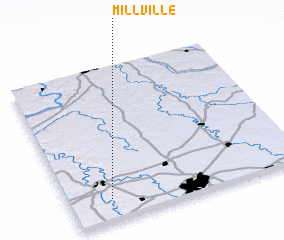 Places with similar names to Millville, United States - USA ::
// Mollaveli (AZ)
// Mellow Valley (US)
// Millville (US)
// Millville (US)
// Mill Valley (US)
// Millville (US)
// Millville (US)
// Millville (US)
// Millville (US)
// Melville (US)
Disclaimer :: Information on this page comes without warranty of any kind |
||
|
Where is Millville? Elevation and coordinates ::
Latitude (lat): 38°8'13"N Longitude (lon): 84°49'19"W
Elevation (approx.): 176m (map arrows pan, magnifying glasses zoom) |
||
|
Visiting Millville? Hotel/Accommodation ::
Book a hotel in Millville Travel Guide ::
rental cars ::
car rental offers GPS waypoint ::
download a GPX waypoint (PoI) of Millville for your GPS receiver
|
||