|
search place name
|
||
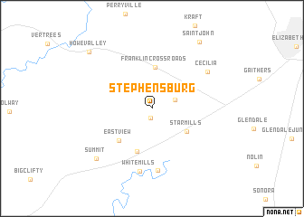
Stephensburg (Kentucky, United States - USA)Stephensburg is a town in the Kentucky region of United States - USA. An overview map of the region around Stephensburg is displayed below.
regional and 3d topo map of Stephensburg, United States - USA ::
Stephensburg airports ::
The nearest airport is FTK - Fort Knox Godman Aaf, located 31.6 km north of Stephensburg.
Other airports nearby include LOU - Louisville Bowman Fld (73.9 km north east), HOP - Hopkinsville Campbell Aaf (168.8 km south west), BNA - Nashville Intl (176.6 km south), CVG - Cincinnati Northern Kentucky Intl (197.3 km north east), Nearby towns ::
Old Stephensburg (1.1km south) //
Hansbrough (2.5km north east) //
Franklin Cross Roads (5.0km north) //
Star Mills (4.4km south east) //
White Mills Junction (5.5km south) //
Eastview (5.1km south west) //
Harcourt (7.7km south) //
White Mills (7.8km south) //
Cecilia (7.1km north east) //
Summit (8.3km south west) //
Saint John (9.4km north east) //
Howe Valley (9.3km north west) //
[all distances 'as the bird flies' and approximate] 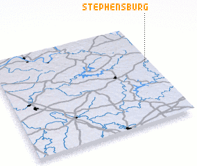 Places with similar names to Stephensburg, United States - USA ::
// Stefansberg (AT)
// Stefansberg (AT)
// Stephansberg (DE)
// Stephensburg (US)
// Stevensburg (US)
// Stephansberg (DE)
// Stevensburg (US)
Disclaimer :: Information on this page comes without warranty of any kind |
||
|
Where is Stephensburg? Elevation and coordinates ::
Latitude (lat): 37°37'29"N Longitude (lon): 86°1'8"W
Elevation (approx.): 211m (map arrows pan, magnifying glasses zoom) |
||
|
Visiting Stephensburg? Hotel/Accommodation ::
Book a hotel in Stephensburg Travel Guide ::
rental cars ::
car rental offers GPS waypoint ::
download a GPX waypoint (PoI) of Stephensburg for your GPS receiver
|
||