|
search place name
|
||
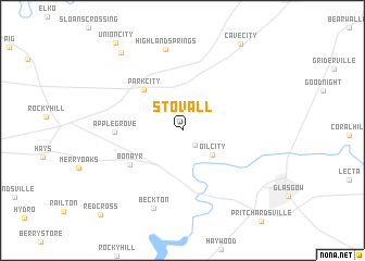
Stovall (Kentucky, United States - USA)Stovall is a town in the Kentucky region of United States - USA. An overview map of the region around Stovall is displayed below.
regional and 3d topo map of Stovall, United States - USA ::
Stovall airports ::
The nearest airport is FTK - Fort Knox Godman Aaf, located 94.5 km north of Stovall.
Other airports nearby include BNA - Nashville Intl (119.4 km south west), LOU - Louisville Bowman Fld (133.6 km north), HOP - Hopkinsville Campbell Aaf (139.3 km west), CVG - Cincinnati Northern Kentucky Intl (250.6 km north east), Nearby towns ::
Carden (1.9km south east) //
Oil City (3.5km south east) //
Park City (5.3km north west) //
Bon Ayr (5.6km south west) //
Apple Grove (5.5km west) //
Highland Springs (8.5km north) //
Beckton (8.4km south) //
Chaumont (9.5km north west) //
Red Cross (10.9km south west) //
[all distances 'as the bird flies' and approximate] 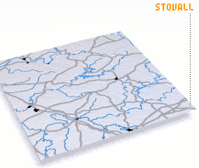 Places with similar names to Stovall, United States - USA ::
Disclaimer :: Information on this page comes without warranty of any kind |
||
|
Where is Stovall? Elevation and coordinates ::
Latitude (lat): 37°3'23"N Longitude (lon): 86°0'37"W
Elevation (approx.): 221m (map arrows pan, magnifying glasses zoom) |
||
|
Visiting Stovall? Hotel/Accommodation ::
Book a hotel in Stovall Travel Guide ::
rental cars ::
car rental offers GPS waypoint ::
download a GPX waypoint (PoI) of Stovall for your GPS receiver
|
||