|
search place name
|
||
Vanhook (Kentucky, United States - USA)Vanhook is a town in the Kentucky region of United States - USA. An overview map of the region around Vanhook is displayed below.
regional and 3d topo map of Vanhook, United States - USA ::

Vanhook airports ::
The nearest airport is LOU - Louisville Bowman Fld, located 158.2 km north west of Vanhook.
Other airports nearby include FTK - Fort Knox Godman Aaf (158.6 km north west), TYS - Knoxville Mc Ghee Tyson (159.9 km south), CVG - Cincinnati Northern Kentucky Intl (205.0 km north), LUK - Cincinnati Muni Lunken Fld (209.7 km north), Nearby towns ::
Plato (2.5km north west) //
Sinking Valley (3.5km south) //
Bloss (3.7km east) //
Dahl (4.6km south west) //
Conrard (5.4km south east) //
Hansford (6.8km north east) //
Elrod (6.0km west) //
Level Green (7.8km north) //
Stab (7.6km south west) //
Valley Oak (6.8km south west) //
Walnut Grove (7.7km north west) //
Pongo (7.1km east) //
Sandy Gap (8.7km south east) //
Shopville (9.2km south west) //
Squib (9.3km south east) //
[all distances 'as the bird flies' and approximate] 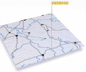 Places with similar names to Vanhook, United States - USA ::
// Fann-Hok (SN)
// Vinhaça (BR)
// Phú Nhiêu (2) (VN)
// Vân Hòa (2) (VN)
// Vân Hội (2) (VN)
// Funehiki (JP)
Disclaimer :: Information on this page comes without warranty of any kind |
||
|
Where is Vanhook? Elevation and coordinates ::
Latitude (lat): 37°12'50"N Longitude (lon): 84°24'8"W
Elevation (approx.): 295m (map arrows pan, magnifying glasses zoom) |
||
|
Visiting Vanhook? Hotel/Accommodation ::
Book a hotel in Vanhook Travel Guide ::
rental cars ::
car rental offers GPS waypoint ::
download a GPX waypoint (PoI) of Vanhook for your GPS receiver
|
||