|
search place name
|
||
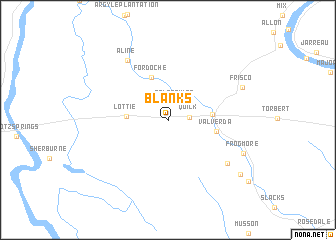
Blanks (Louisiana, United States - USA)Blanks is a town in the Louisiana region of United States - USA. An overview map of the region around Blanks is displayed below.
regional and 3d topo map of Blanks, United States - USA ::
Blanks airports ::
The nearest airport is BTR - Baton Rouge Metro Ryan Fld, located 43.3 km east of Blanks.
Other airports nearby include LFT - Lafayette Rgnl (53.6 km south west), ESF - Alexandria Esler Rgnl (114.6 km north west), AEX - Alexandria Intl (124.9 km north west), MSY - Louis Armstrong New Orleans Intl (143.3 km south east), Nearby towns ::
False River (2.0km north) //
Quick (2.1km east) //
Lottie (4.0km west) //
Livonia (4.3km east) //
Fordoche (5.0km north) //
Valverda (4.8km east) //
Aline (7.7km north west) //
Kenmore (7.5km south east) //
Frisco (8.0km north east) //
Frogmore (8.2km south east) //
Sparks (9.3km south east) //
[all distances 'as the bird flies' and approximate]  Places with similar names to Blanks, United States - USA ::
// Balingasao (PH)
// Balingasay (PH)
// Bulangsi (PH)
// Bahlings (DE)
// Billings (DE)
// Balangāz (IQ)
// Belengöz (TR)
// Blancas (ES)
// Blancos (ES)
// Billings (RU)
Disclaimer :: Information on this page comes without warranty of any kind |
||
|
Where is Blanks? Elevation and coordinates ::
Latitude (lat): 30°33'11"N Longitude (lon): 91°36'1"W
Elevation (approx.): 15m (map arrows pan, magnifying glasses zoom) |
||
|
Visiting Blanks? Hotel/Accommodation ::
Book a hotel in Blanks Travel Guide ::
rental cars ::
car rental offers GPS waypoint ::
download a GPX waypoint (PoI) of Blanks for your GPS receiver
|
||