|
search place name
|
||
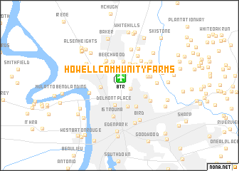
Howell Community Farms (Louisiana, United States - USA)Howell Community Farms is a town in the Louisiana region of United States - USA. An overview map of the region around Howell Community Farms is displayed below.
regional and 3d topo map of Howell Community Farms, United States - USA ::
Howell Community Farms airports ::
The nearest airport is BTR - Baton Rouge Metro Ryan Fld, located 1.2 km north of Howell Community Farms.
Other airports nearby include LFT - Lafayette Rgnl (87.7 km south west), MSY - Louis Armstrong New Orleans Intl (104.1 km south east), NBG - New Orleans Nas Jrb (132.5 km south east), ESF - Alexandria Esler Rgnl (145.9 km north west), Nearby towns ::
Howell (0.7km east) //
Zion City (1.6km east) //
Liberty Farms (2.2km north) //
Scotlandville (2.6km west) //
Gibbens Place (3.1km north) //
Delmont Place (3.2km south) //
Kingston Estates (3.4km north) //
Holiday Acres (3.4km north) //
North Highlands (3.5km south) //
Maryland (3.5km north west) //
Ellen Place (3.6km north east) //
Engleswood (3.7km north) //
Harding Heights (3.7km north) //
Maryland Heights (3.7km north west) //
Beechwood (3.9km north) //
Cunnard Place (3.9km north west) //
Brownsfield (3.9km north east) //
Brookstown (4.0km south east) //
Brownfields (4.0km north east) //
Kings Estates (4.2km north west) //
Greendale (3.9km south east) //
Greenwood Estates (4.1km north east) //
Pleasant Hills (4.0km east) //
Klienpeter Terrace (4.4km north east) //
Mengel Landing (4.3km west) //
Istrouma (4.9km south) //
Green Acres (4.4km east) //
Yorkdale (4.9km north east) //
Merrydale (4.8km south east) //
[all distances 'as the bird flies' and approximate] 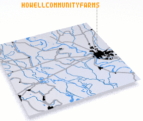 Places with similar names to Howell Community Farms, United States - USA :: Disclaimer :: Information on this page comes without warranty of any kind |
||
|
Where is Howell Community Farms? Elevation and coordinates ::
Latitude (lat): 30°31'22"N Longitude (lon): 91°9'6"W
Elevation (approx.): 22m (map arrows pan, magnifying glasses zoom) |
||
|
Visiting Howell Community Farms? Hotel/Accommodation ::
Book a hotel in Howell Community Farms Travel Guide ::
rental cars ::
car rental offers GPS waypoint ::
download a GPX waypoint (PoI) of Howell Community Farms for your GPS receiver
|
||