|
search place name
|
||
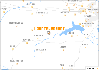
Mount Pleasant (Louisiana, United States - USA)Mount Pleasant is a town in the Louisiana region of United States - USA. An overview map of the region around Mount Pleasant is displayed below.
regional and 3d topo map of Mount Pleasant, United States - USA ::
Mount Pleasant airports ::
The nearest airport is MLU - Monroe Rgnl, located 25.9 km east of Mount Pleasant.
Other airports nearby include ELD - El Dorado South Arkansas Rgnl At Goodwin Fld (99.0 km north west), ESF - Alexandria Esler Rgnl (116.0 km south), AEX - Alexandria Intl (125.7 km south), BAD - Shreveport Barksdale Afb (128.3 km west), Nearby towns ::
Cadeville (3.9km west) //
Mineral Springs (5.9km west) //
Okaloosa (7.2km south) //
Lapine (7.2km south east) //
Forksville (7.7km north) //
Lenwil (7.1km east) //
Guyton (7.9km south west) //
Cheniere (9.0km north east) //
Calhoun (9.7km north west) //
[all distances 'as the bird flies' and approximate] 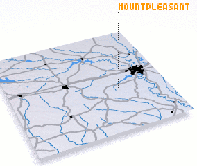 Places with similar names to Mount Pleasant, United States - USA ::
// Mount Pleasant (US)
// Mount Pleasant (US)
// Mount Pleasant (US)
// Mount Pleasant (US)
// Mount Pleasant (US)
// Mount Pleasant (US)
// Mount Pleasant (US)
// Mount Pleasant (US)
// Mount Pleasant (US)
// Mount Pleasant (US)
Disclaimer :: Information on this page comes without warranty of any kind |
||
|
Where is Mount Pleasant? Elevation and coordinates ::
Latitude (lat): 32°26'27"N Longitude (lon): 92°18'0"W
Elevation (approx.): 42m (map arrows pan, magnifying glasses zoom) |
||
|
Visiting Mount Pleasant? Hotel/Accommodation ::
Book a hotel in Mount Pleasant Travel Guide ::
rental cars ::
car rental offers GPS waypoint ::
download a GPX waypoint (PoI) of Mount Pleasant for your GPS receiver
|
||