|
search place name
|
||
Rocky Branch (Louisiana, United States - USA)Rocky Branch is a town in the Louisiana region of United States - USA. An overview map of the region around Rocky Branch is displayed below.
regional and 3d topo map of Rocky Branch, United States - USA ::

Rocky Branch airports ::
The nearest airport is MLU - Monroe Rgnl, located 24.2 km south east of Rocky Branch.
Other airports nearby include ELD - El Dorado South Arkansas Rgnl At Goodwin Fld (82.9 km north west), BAD - Shreveport Barksdale Afb (138.4 km west), ESF - Alexandria Esler Rgnl (142.6 km south), AEX - Alexandria Intl (153.4 km south), Nearby towns ::
Crossroads (5.0km north) //
Loch Lomond (5.7km east) //
Point (7.2km west) //
Wall Lake (7.7km south east) //
Spencer (9.6km north east) //
Wilhite (10.0km south west) //
[all distances 'as the bird flies' and approximate] 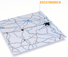 Places with similar names to Rocky Branch, United States - USA ::
// Rocky Branch (US)
// Rock Branch (US)
// Rockybranch (US)
// Rock Branch (US)
// Rocky Branch (US)
// Rocky Branch (US)
// Rocky Branch (US)
// Rock Branch (US)
Disclaimer :: Information on this page comes without warranty of any kind |
||
|
Where is Rocky Branch? Elevation and coordinates ::
Latitude (lat): 32°40'43"N Longitude (lon): 92°12'11"W
Elevation (approx.): 54m (map arrows pan, magnifying glasses zoom) |
||
|
Visiting Rocky Branch? Hotel/Accommodation ::
Book a hotel in Rocky Branch Travel Guide ::
rental cars ::
car rental offers GPS waypoint ::
download a GPX waypoint (PoI) of Rocky Branch for your GPS receiver
|
||