|
search place name
|
||
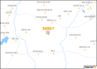
Shady (Louisiana, United States - USA)Shady is a town in the Louisiana region of United States - USA. An overview map of the region around Shady is displayed below.
regional and 3d topo map of Shady, United States - USA ::
Shady airports ::
The nearest airport is BAD - Shreveport Barksdale Afb, located 83.2 km north west of Shady.
Other airports nearby include MLU - Monroe Rgnl (85.3 km north east), SHV - Shreveport Rgnl (95.4 km west), AEX - Alexandria Intl (99.8 km south), ESF - Alexandria Esler Rgnl (102.8 km south east), Nearby towns ::
Danville (4.7km north) //
Friendship (6.2km north) //
Mill (7.4km south) //
Loe (7.2km north east) //
Brewtons Mill (7.6km south) //
Pine Ridge (8.2km south west) //
New Friendship (8.6km north) //
Carolina (7.4km west) //
English (10.3km north east) //
[all distances 'as the bird flies' and approximate] 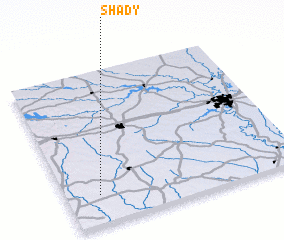 Places with similar names to Shady, United States - USA ::
Disclaimer :: Information on this page comes without warranty of any kind |
||
|
Where is Shady? Elevation and coordinates ::
Latitude (lat): 32°11'15"N Longitude (lon): 92°51'35"W
Elevation (approx.): 68m (map arrows pan, magnifying glasses zoom) |
||
|
Visiting Shady? Hotel/Accommodation ::
Book a hotel in Shady Travel Guide ::
rental cars ::
car rental offers GPS waypoint ::
download a GPX waypoint (PoI) of Shady for your GPS receiver
|
||